
|
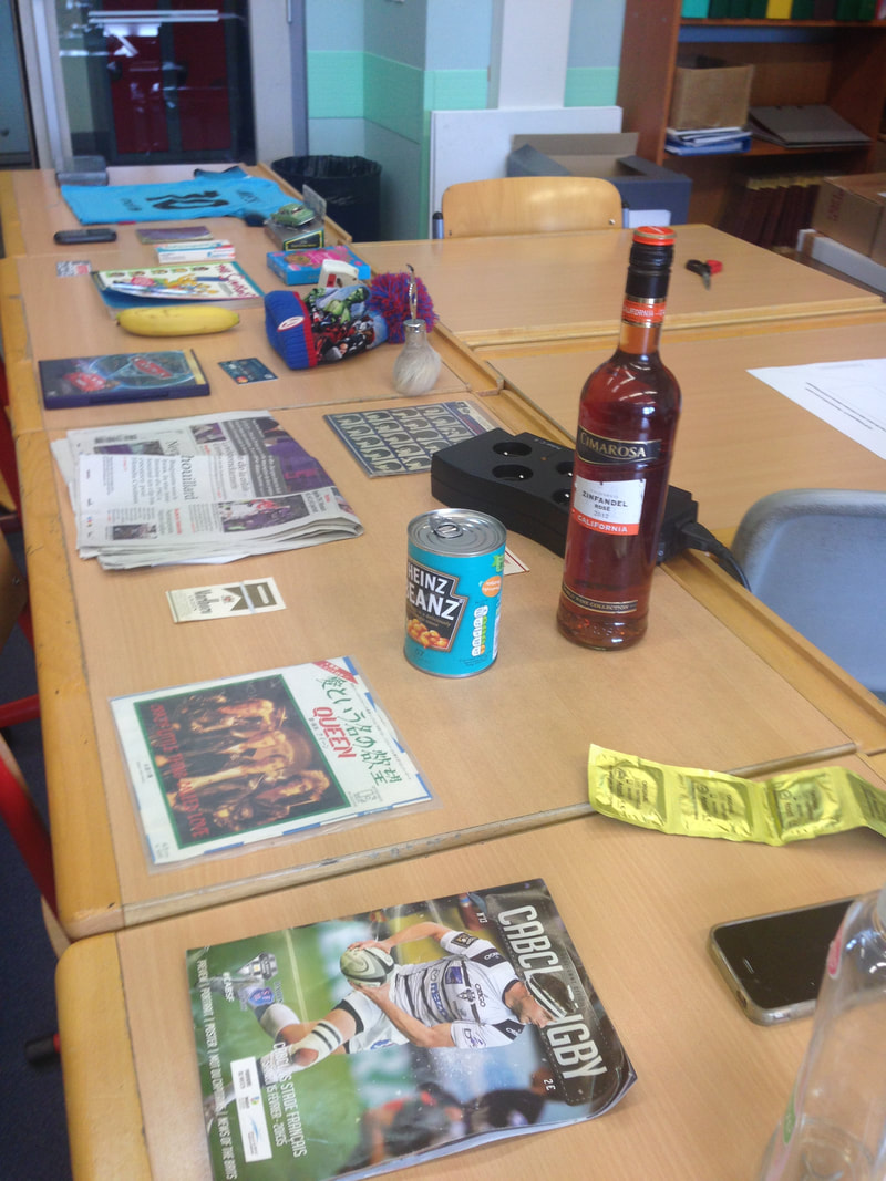
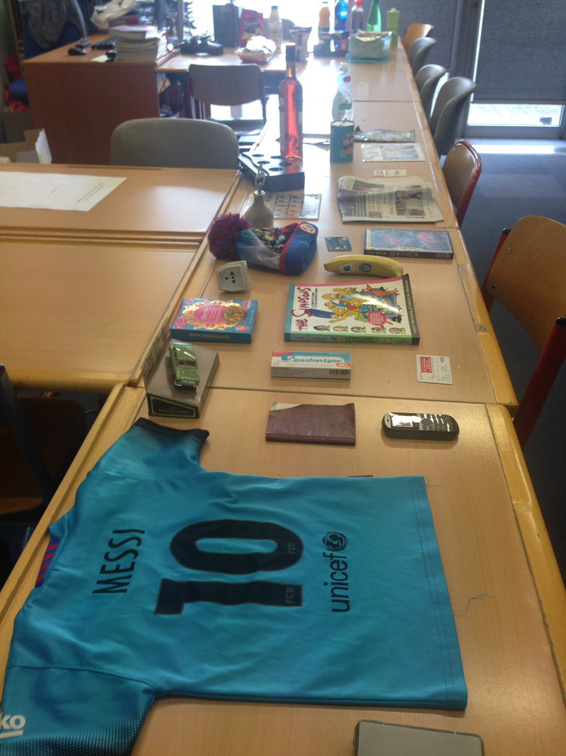
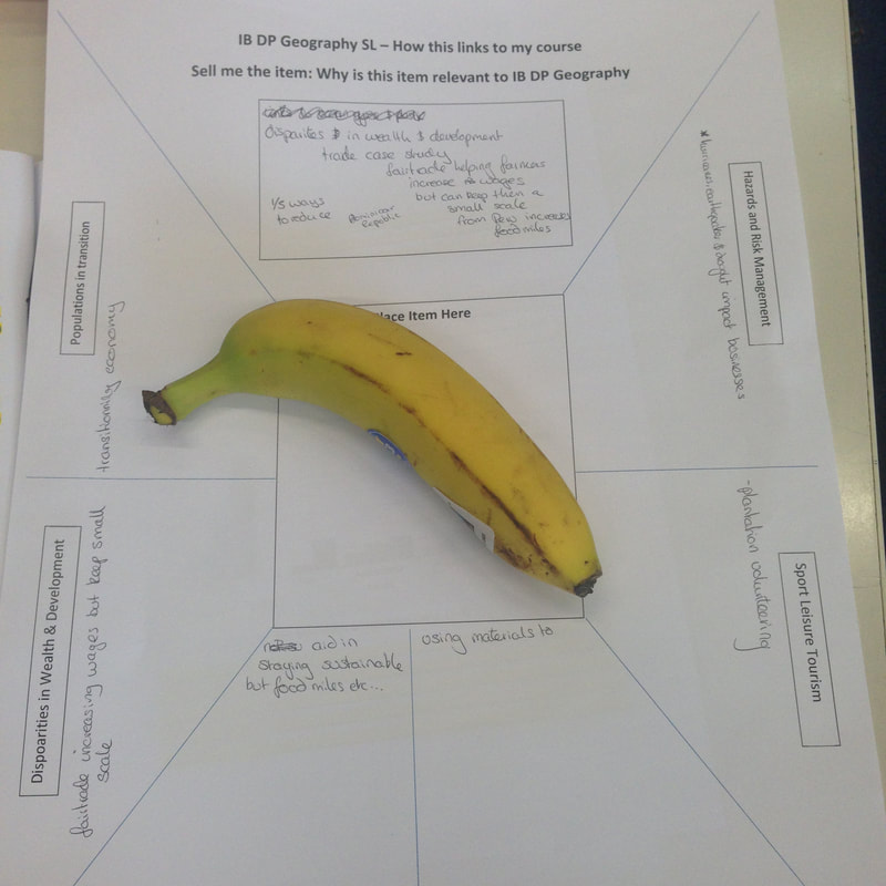
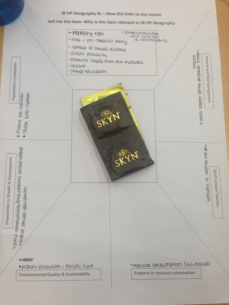
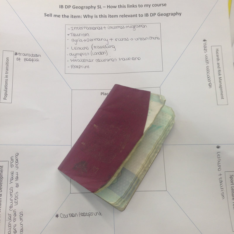
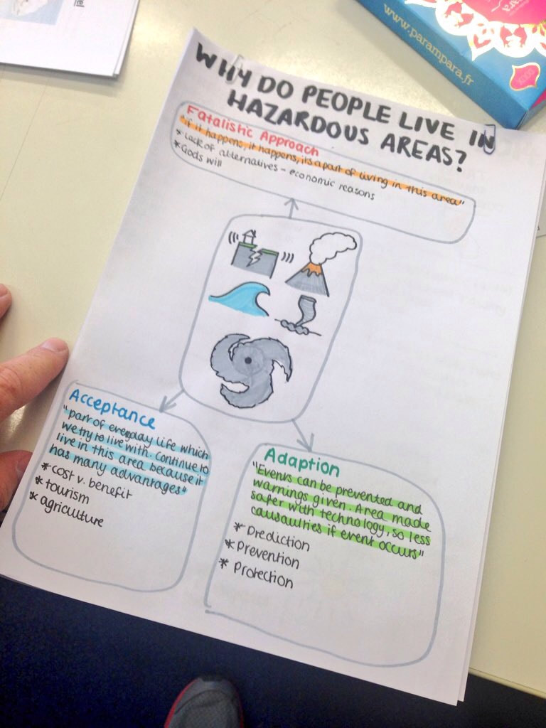
I ran the last ever revision session for the old specification today for my SL & HL students. Here are the resources that I used. The PowerPoint with basic resources can be found below. Some funny memes can be found out there to lighten the mood a little and so were added at key points in the sesson. Our first activity was based around linking different elements of the SL syllabus together. Here in Toulouse, as well as the Core, we also study Sport Leisure and Tourism and Hazards as our two core options. As the students are pretty snowed under with their numerous case studies, I thought a lighter approach was needed and so gathered together 30 random household items (+ one specific item from the Sex Ed kit). I gave each item a brief introduction before the students had to come to the front to choose their item.
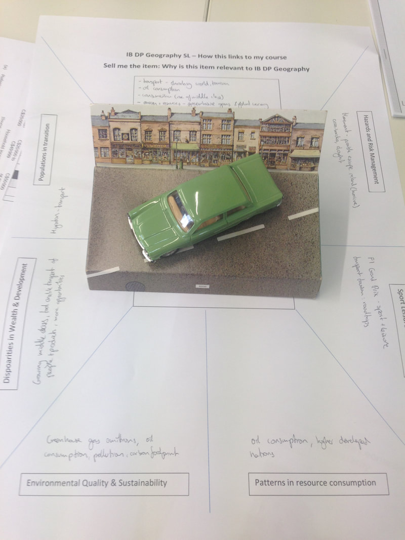
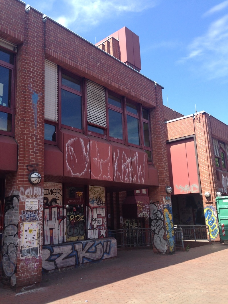
The students then had to place their everyday item in the centre of the A3 sheet below and spend 4 minutes writing out a sales pitch to tell me why the item was vital to their IB DP SL studies. After each student had read their pitch, they were then to continue linking their item to different elements of the core and optional units. There was some good discussion here RE the Barcelona FC shirt was linked to the Sport, Leisure & Tourism unit but also further to outsourcing (garment factory in Vietnam), sponsorship Qatar Airlines (oild wealth, resource consumption, geopolitics, and UNICEF links to aid, disparities, MDG's etc. Messi is an Argentinian player and so economic migration was mentioned together with the protest in Catalonia and links to Nationalism in the HL spec. The condom example proved popular although unsure that the students knew that the major component was rubber and not oil! This proved to be a valuable activity and brought out the synthesis required to stitch together the course and allow them to think more widely about A03 type responses in the 10 & 15 mark sections of all papers. It is also proved a point that if they have a brain blank in the exam with a particular case study, they have enough geographical knowledge to 'borrow' a case study from elsewhere and adapt to fit the question. If they can do it with condoms, cars and bananas...!!
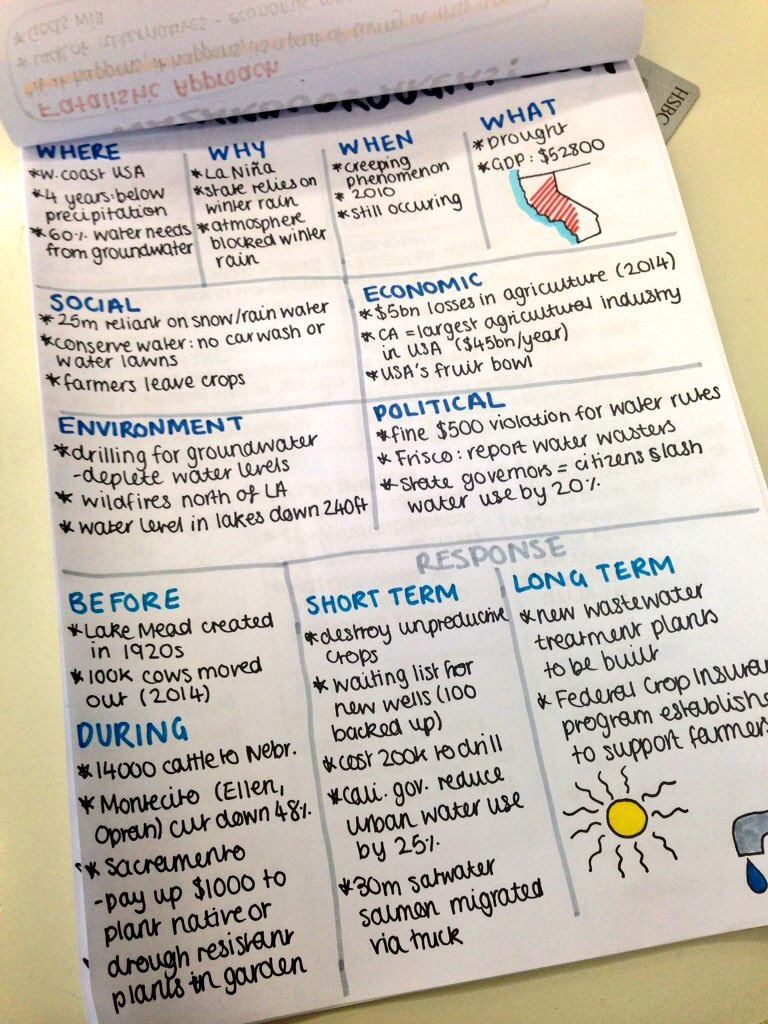
We then moved onto a piece of work on command terms and a refresher on the A01, A02 and A03 approach in paper 1 & 2. The following worksheet was cut up into slips and the students had to match up the command term with definition. This took about 15 minutes and the students coped surprisingly well with it. I suppose they should have done given the huge number of essays they've written over their IB careers. We then moved on to a paper that I'd prepared using the revision grids (see below) so show the spread of questions for each unit of work since 2011. I'd identified gaps where I thought questions might be asked later this week and altered previous questions to reflect parts of the syllabus that had not yet been tested. We then had a look at the Core unit and paper 1. The students worked their way through the activities specifically focusing on the yellow highlighted questions. After a short break, we then did the same for Paper 2, namely Sport, Leisure & Tourism. At this point , the SL students were released and we then focused on HL only. We didn't do any particular essay practise for Paper 3 as the students have had plenty of opportunity to hone these skills. However, we did repeat the first exercise where I gave each HL student and item and they had to link it to firstly sell it to me and then link to a different part of the HL course using the crib sheet below. The items were a Disney Pixar Cars DVD (in French), a plastic washing up liquid bottle(Colgate but made in France), and an iPhone 4. We then had a quick look at some questions spotting for Option A - Freshwater (above). Bit of time at the end for last minute questions and a few abbreviations to help them remember the tourism and sport case studies. Tourism - R.E.D.R.U.N Rural Area, Ecotourism, Development Strategy, Remote Areas, Urban Area, National Sport P.U.N.C.S Participation & Success, Urban Regeneration, National League, Contemporary Event, Supporters (residence of) Kate also shared with us some of her most excellent revision notes for each and every part of the course! We were well impressed!
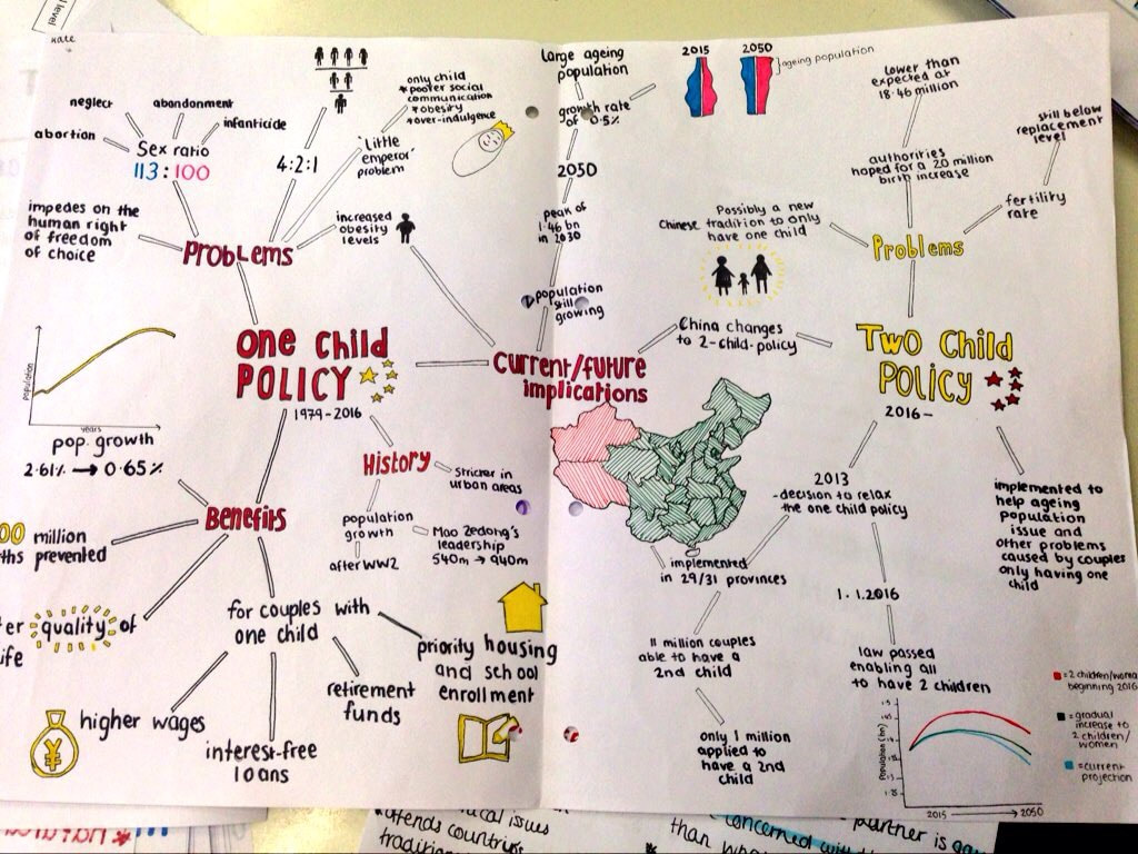 One Child Policy Mind Map 
1 Comment
Details:
Sunday PM - Urban Change & Evidence of Gentrification IB DP & IGCSE (single opter) Geographers
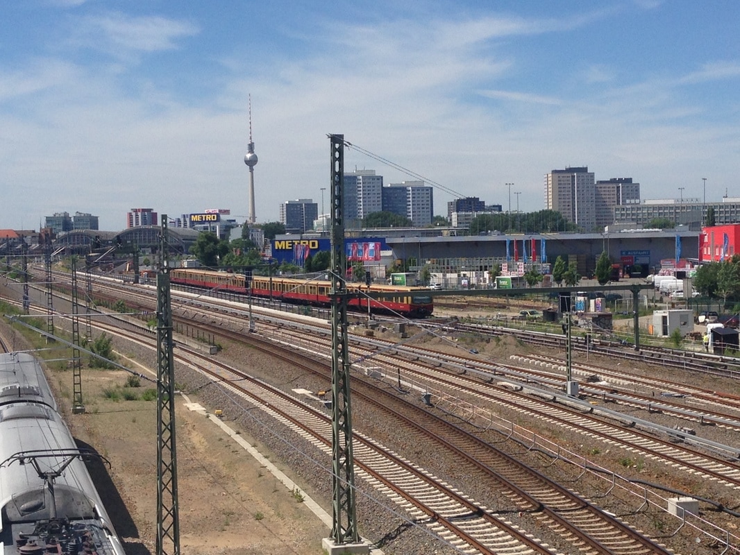
Evening meal then activities. Monday IB DP & IGCSE (single opter) Geographers AM - Berlin Settlement Patterns - Modeling it. Walk down to the Spree and then along to Berliner Stadt-Modelle - Senate Department for Urban Development and Housing http://www.stadtentwicklung.berlin.de/planen/stadtmodelle/en/ausstellung.shtml Spend up to 1 hour in the museum completing background tasks and with talk from planning officer. Then walk to U Märkisches Museum and taking U2 to U Nollendorfplatz before changing for the U1 and exiting at U Uhlandstr. PM - History of Berlin Museum and Bunker Tour
Once the tour of the museum is over, the students to tour the underground bunker a short walk from the museum. This was the reality of Cold War Berlin! PM - The Wall 360°
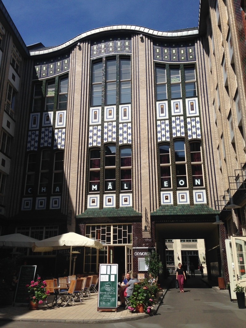
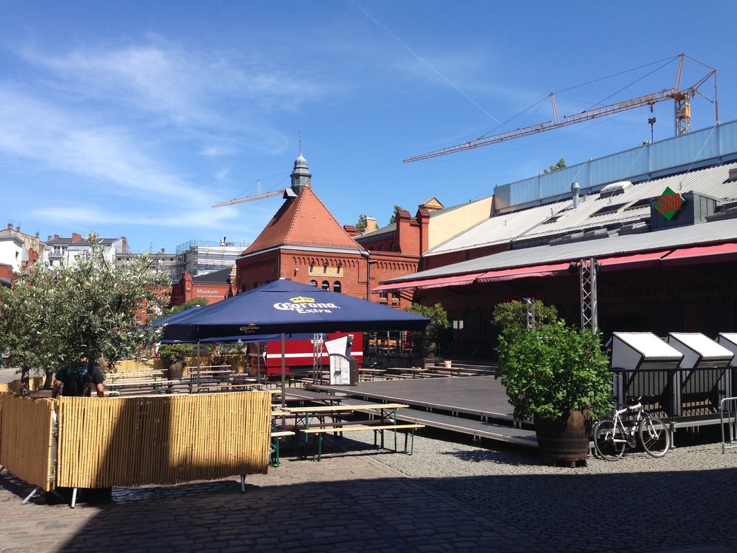
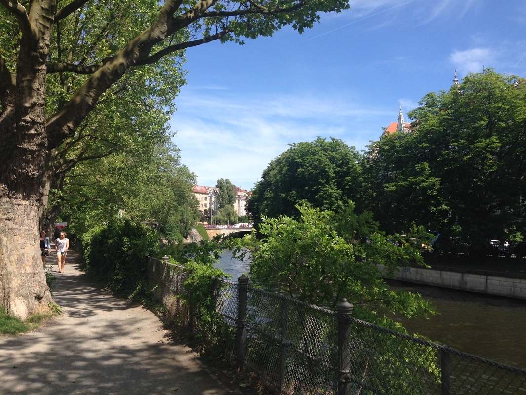
Evening meal then activities. Tuesday - Fieldwork & Data Collection IBDP & all IGCSE Geography students (31 in total) This piece of work will be based around the itinerary offered by Insider Tours and will be run by Nikolai (excellent, knowledgeable guide). Survey Types 1. Adjective Pair Survey 2. Index of Services & Amenities 3. Index of Residential Decay 4. Perception Survey 5. Environmental Survey 6. Conflict Matrix Stage 1 - Meet at AM - Meet at Hackescher Market, next to the metro station. This is an excellent location to start the study and would allow students to complete on of their first surveys of the areas. There has been clear gentrification of the area since 1989 with old railway arches being turned into trendy bars, chains food stores with only one original German beer bar. 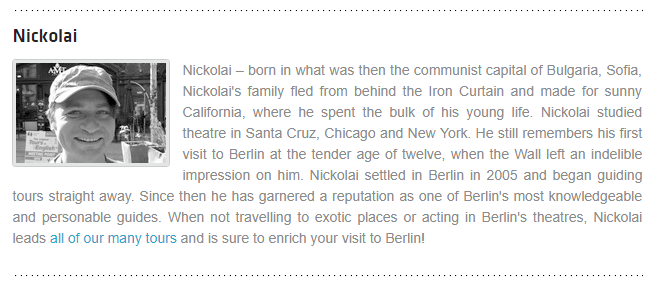
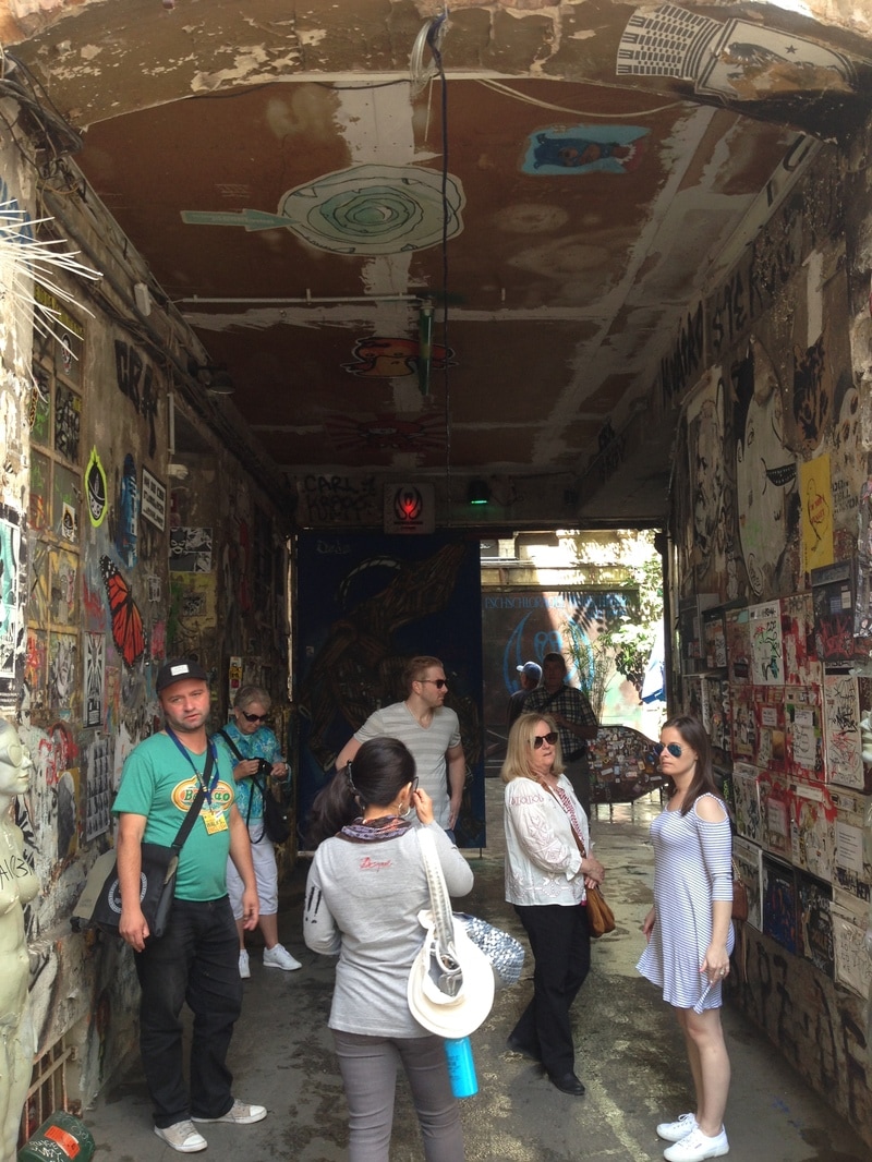
Stage 2 - Cross the road and head up to the two contrasting courtyards.
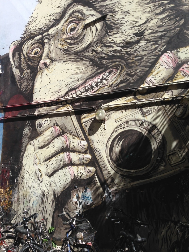
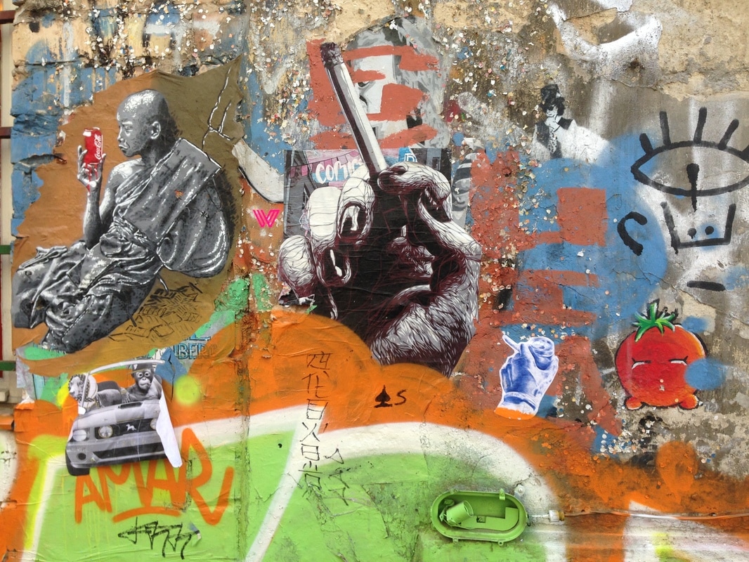
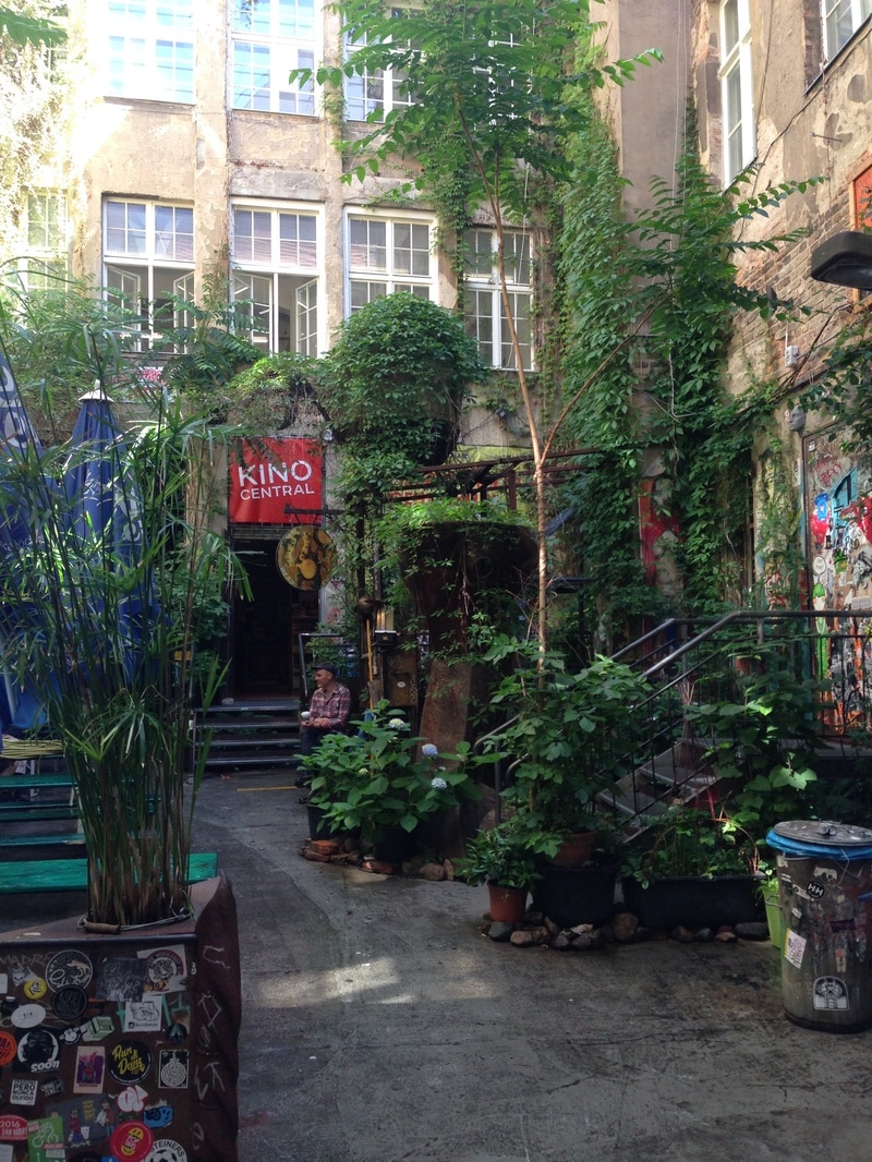
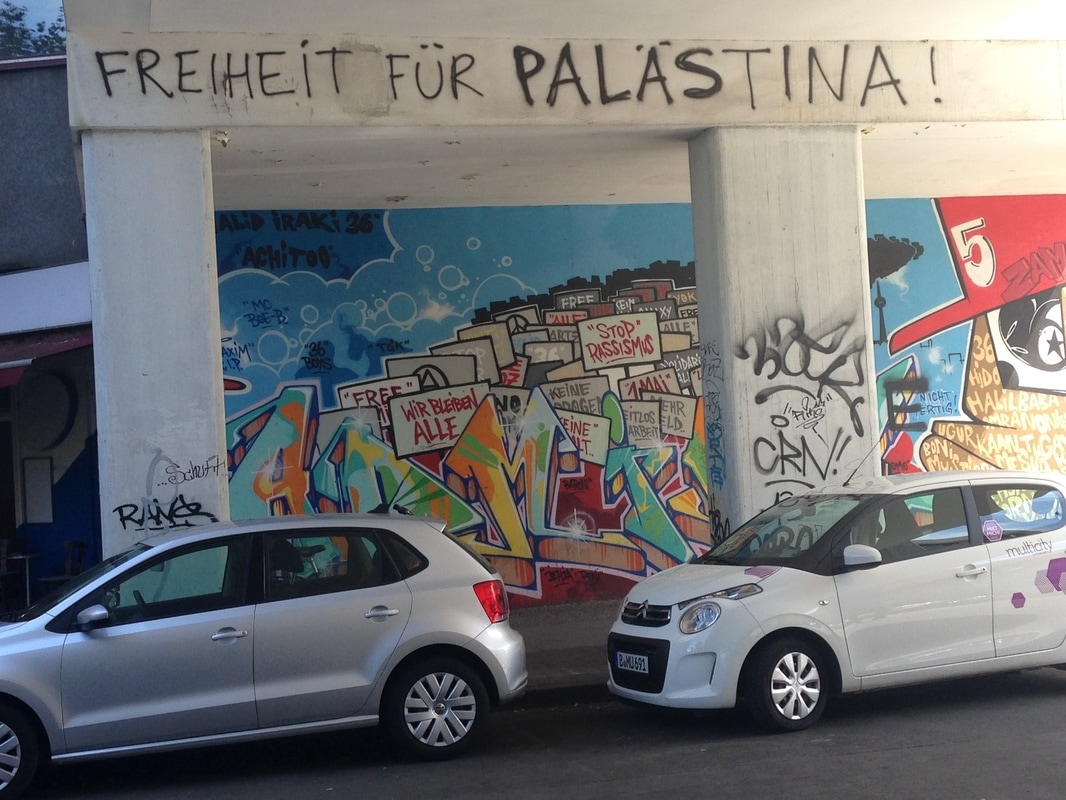
Students could complete comparative surveys on perception and security in both places. Further explanation as to the 75 year laws preventing gentrification and preserving owner rights (in the second courtyard) would be required here. Particular note should be taken of the graffiti in particular the anti globalization & any spying artwork that adorns many of the walls. There is an excellent alternative bar at the rear of the courtyard that would make an excellent focus for the surveys.
TRAM RIDE
Stage 3 -Schonhauser Allee - Gentrification centre of Berlin
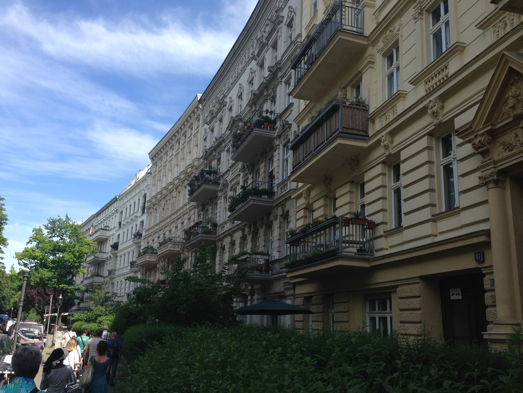
In this area, prices of property have spiraled out of control to some extent in the past 10 years. Many people have moved in particularly from Stuttgart where property prices are high & those who have footloose jobs are able to work from Berlin whilst enjoying the culture and activities that the city brings. Many traditional residents are still around, noticeably in the apartment block above. This has never been modernised but landlords are able to use property laws in particular "modernisation of apartment" or "aesthetic laws" to carry out work, before hiking up the prices and forcing those people out. The example above shows a block of apartments that has been modernised (green) but the one next door which is in quite a state of decay despite it being right in the centre of this now desirable neighbourhood.
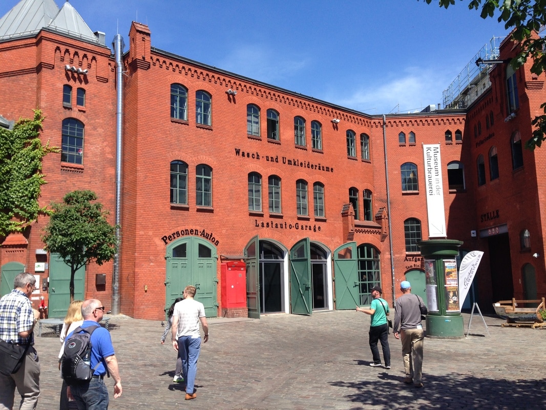
Students to carry out a number of surveys here, comparing both buildings & amenity surveys/property price etc. Note that this is the home area of Rammstein - an industrial metal and now world famous music group. There might be some research to be done beforehand on their early videoes & lyrics particularly linking in with this neighbourhood and that the fact that to some extent, their music has been 'gentrified' too as their international fan base has increased. Stage 4 - Walk along Schonhauser Allee before turning left into the former Kulturbrauerei.
Old brewery complex that has now been repurposed as an entertainments complex with Dance studios, bars etc. This is an example of a scheme that has been brought about by foreign investment, in the case from Iceland, but many other projects in the area have been funded by Swedish & Norwegian companies too. There is some growing resentment to these 'foreign' owned speculators but Berlin council still has overall control as to who buys what & where and therefore to some extent some 'blame' as far as the far left see it.
Excellent area for surveys, photography and land use survey (will need plan of the site with each building present for identification purposes).
Stage 5 - Walk out of the brewery complex and onto Danzinger Strasse. Here is a long and wide artery road where as Nikolei terms it 'yummy mummies and yummy daddies' hang out. It's a very hip and trendy area with cool bars, world food outlets, very specialist shops and a mixture of childrens toy shops. Perception survey possible on 100 metre stretch of this road but could also be knocked off the itinerary if we are pressed for time. Interesting to note that Google Streetview hasn't been completed on most of Berlin since 2008. Therefore using this evidence or simply to time slide facility, students could use this to see the development of the area over the last 10 years. Think about producing laminated image sheets before setting off.
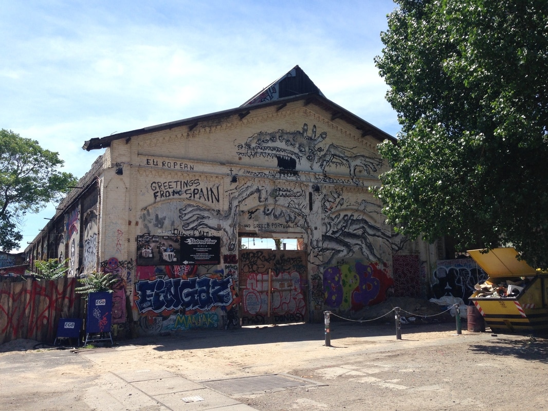
Stage 6 - Long tram ride along Danzinger Strasse, past Frankfurter Tor and to the bombed out buildings on Revaler Strasse. The area is called Urban Spree and has its own website - http://www.urbanspree.com or @Urban_Spree. This is a very edgy part of the tour where students are able to see space that has not been developed commercially but has simply been left to the use of a particular demographic. The complex (note the difference between the Brewery & here) includes a 'hipster' swimming pool, concert venues, bars and open air party venues. This would be excellent for the majority of the perception surveys, decay index etc. Students will need 30 minutes or so to explore the area.
Lunch Break Opportunity here - Excellent Middle East restaurant just at the exit to the complex. Allow 45 minutes to eat & drink. Food menus available for less than €5.00 including a drink. Link here to reviews & menu - https://www.yelp.com/biz/haroun-al-rachid-berlin
Stage 7 - Newly constructed (and still under major construction) entertainments complex. This includes the Mercedes Benz. Stop on the corner of Helsingforser Strasse / Warschauer Strasse. Huge amount of renewal of the old industrial river side area / railway sheds to create the Mercedes Benz concert arena. Zoning of clubs, concert venue, restaurants & also the biggest Gay area of Berlin too with a thriving scene (note comparison to Sitges).
Conflict Matrix could be carried out here as well as a comparison of current level of development v's historical images taken from Google Streetview below (2008) and time slider.
Stage 8 - Turkish Quarter - Take the tram along from Warschauer Strasse (crossing into the East of Berlin) station to Kottbusser Tor station (5 minutes). Note to look to the right to see the East Side Gallery (1.2 km original section of the Berlin Wall). Descend from the station and take a tour through the Turkish market (entrance way shown below on the Google Streetview)
There are currently 500,000 Berliners of Turkish descent making it the highest diaspora population outside of Turkey and the highest in Germany. However, many of the diaspora identify themselves as Kurdish. There have been many years of criticisms from within Germany about the immigration issues and even Merkel has suggested that the diaspora are still not fully integrated. The reasons for this are that many Turks are eligible for naturalisation in Germany however, dual nationality is not permitted. They are second, third and fourth generation, born and bred in the country. However, many also own property in Turkey and use these properties as a base when they return to visit families but also rent out to make money. Strict Turkish laws impede the ownership of property by foreign nationals and so many are reluctant to give up their Turkish passports for German ones as this additional source of income could be put in jeopardy. Interesting to note the impact of the recent Ergodan vote and why he was so keen to host political rallies in the city to push through his new legislation. Also worth noting the satellite dish effect as many of the residents have access to Turkish television through huge satellites fixed to the side of the tenement housing in the area. There has been a diffusion of language that has taken place due to the popular hip hop scene that is dominated by Turkish origin singers. New phrases & word combinations have grown from this and interesting to note the comparisons with N.W.A in the USA & N.T.M in France too. Also, the Turkish that is spoken in Berlin is a fairly antiquated version that was more widely spoken in Turkey in the 1950's. This is some cause for amusement back in Turkey when the German Turks return to their homeland on first pilgrimage etc. Interesting cultural diffusion facets to note although would need German speaker to explain further.
Finish & Walk back to Turkish Market
From this point, we can walk back down Admiralstrasse, across the bridge over the landwehr Canal and down one of the only streets in Berlin (Planufer) to survive the bombardment of WW2. This is a great finish to the walk and gives students an idea of what an affluent neighbourhood of the western Berlin would have looked like originally.
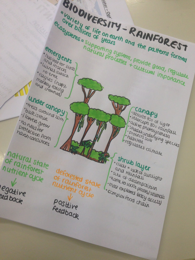
I've just done quite a simple but effective piece of work with Grade 7 / Year 8 on the next section of their work on globalization (Geography of my stuff). Last week, they spent a little time researching the Primary brand and finding out about the growth of the company. A quick search last night found a free GA card sorting exercise which I used as an activity for the first 20 mins of the lesson. I produced my own flow category sheet to try to show the interrelationships between the categories as opposed to the traditional sorting into columns approach and had this copied in A3. The students then cut up the slips (I don't do this) and sorted out the statements into order before a discussion on links, process and systems. The students then stuck their slips around each section ready for the video activity. I showed them the first 15 minutes of the Journeyman report below (careful, there are some images of bodies in the rubble). This report gives a visual overview of the cards and a lot of it is shot through the camera phones of those affected (another opportunity to challenge disparity & mobile phone ownership in LIC's). They also see Mr Rana the day before the disaster dismissing any problem with the structure of the building too! To develop the video task more fully, you could use www.videonot.es to ask the students to write their own captions. That may be a development for the group next year when I have more time. Once the video clip had finished, the 5W's sheet was then given to the students and using both what they had just watched and the stuck down slips diagram, they quickly completed their case study. We had a chat about outsourcing and I gave the group a practical example of how the outsourced company can then sub contract again and again until it become really difficult for the TNC to know exactly where their clothes are being made. Next week takes us on to good news Geography and what has/can be done to make clothes in a safer environment and to talk briefly about how the concept of circular economy (to be introduced at IB level) can apply to the clothing industry. The quote below is a good one for the students to consider as they are completing the work. We are not a number — not only cheap labour and cheap lives. We are human beings like you. Our life is precious like yours, and our dreams are precious too. Grade 6 (Primary) induction day event / french school visit showcaseI have run this lesson twice recently and it has gone down really well both times. The first was for the Grade 6 induction to secondary Geog just before the last summer holidays and the second was for a visit of a local French school to our school for a showcase Geography lesson. The game can be found on Richard Allaway's fantastic geographyalltheway.com website and I stole his chance cards as they worked really well as a way of exposing the EAL visiting students to English geographical terminology (with our students translating those words that were a little abstract). I started off by showing the following video that introduced the students to the concept of population growth ..... We then talked a little about the issues caused by rapid population growth and why population pyramids (age/sex structures) are an important tool in the forecasting of future demographic trends. We talked more about the raising of the retirement age here in France and I showed the students a 2050 population pyramid of France to see if they could work out why. The set up & resources (also see photo at base of post)
When the class come in, tell them not to touch or eat the sweets!
The students start to talk about the cards and you will probably hear them applying the theory to real life events too (if they keep up with the news).
Then lead some questions (if you have time) based on their experiences of the game:
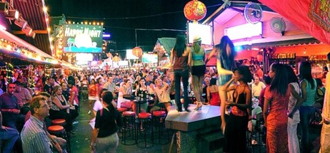
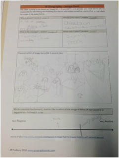
That's it! Simple and fairly cheap to set up and very high in calories! Keep em away from those blue smarties!!! All Richard's original resources can be found on his site here Good luck with it. Matt 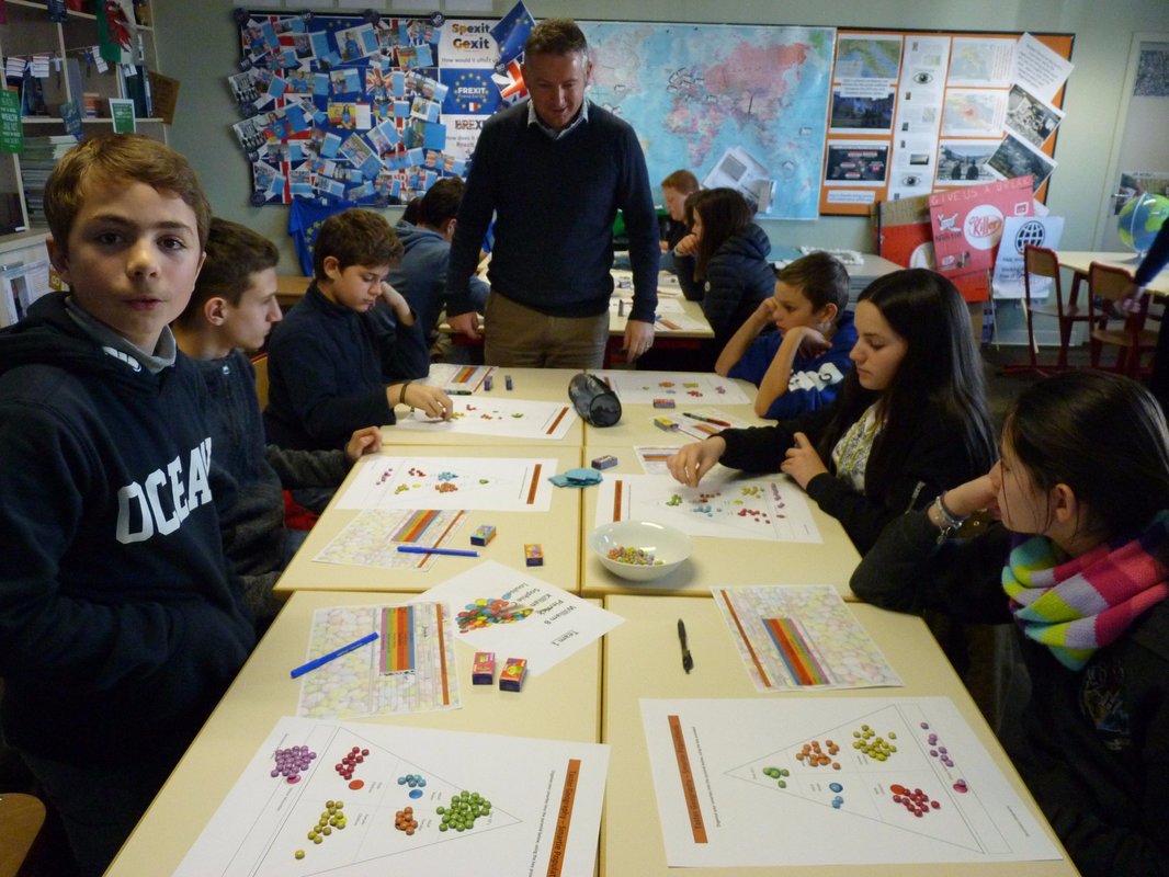 Just been reading Russel Tarr's blog post about a technique he picked up during the #pracped16 conference at school earlier this month. http://www.classtools.net/blog/use-an-image-flash-to-engage-students-with-pictorial-sources/ I'm going to try this out with both of my IB classes this afternoon. G12 are just about to start their work on Malthus and his population theory and so I will be using the first image below. The G11's are just starting on the impacts of tourism on one nation and we'll be focusing on Vietnam. Their image is also below. The students are prearranged into groups and then have 1 second to view the image before the analysis begins (see blog post above for full details). Let's see how it goes. I've put together a framework sheet for each group to use. It can be accessed by clicking on the blue tab below.
Thanks for all for attending the session yesterday up in my teaching room. A the sole teacher of Geography at IST it was a bit of a strange situation to have to many highly esteemed colleagues in my room and the chance to chat a lot about the reactive natures of the subject, associated resources and constraints on us. Interestingly, after Alan Parkinson's (@GeoBlogs) session earlier today, I now wonder how I might adapt the reactive takeaway menu to become more of a 'Blockbusters' type system where all students have to hit one key assessment task over the year?? I need to find out more from him during the Pubaogogies session later this evening in Toulouse. I have included the main resources from the presentation below and links to other pages on the website where you can find resources to be adapted to your own school situation. Useful websites heavily featured are: Fakebook - http://www.classtools.net/FB/home-page Blockposters - http://www.blockposters.com/ Simon Jones - http://fr.slideshare.net/jonesy2008 Twister (fake Twitter) - http://www.classtools.net/twister/ PowerPoint Presentation Embedded below. Please note that this has caused some formatting issues. A download of the original file can be made by clicking on the associated blue tab below this embed. 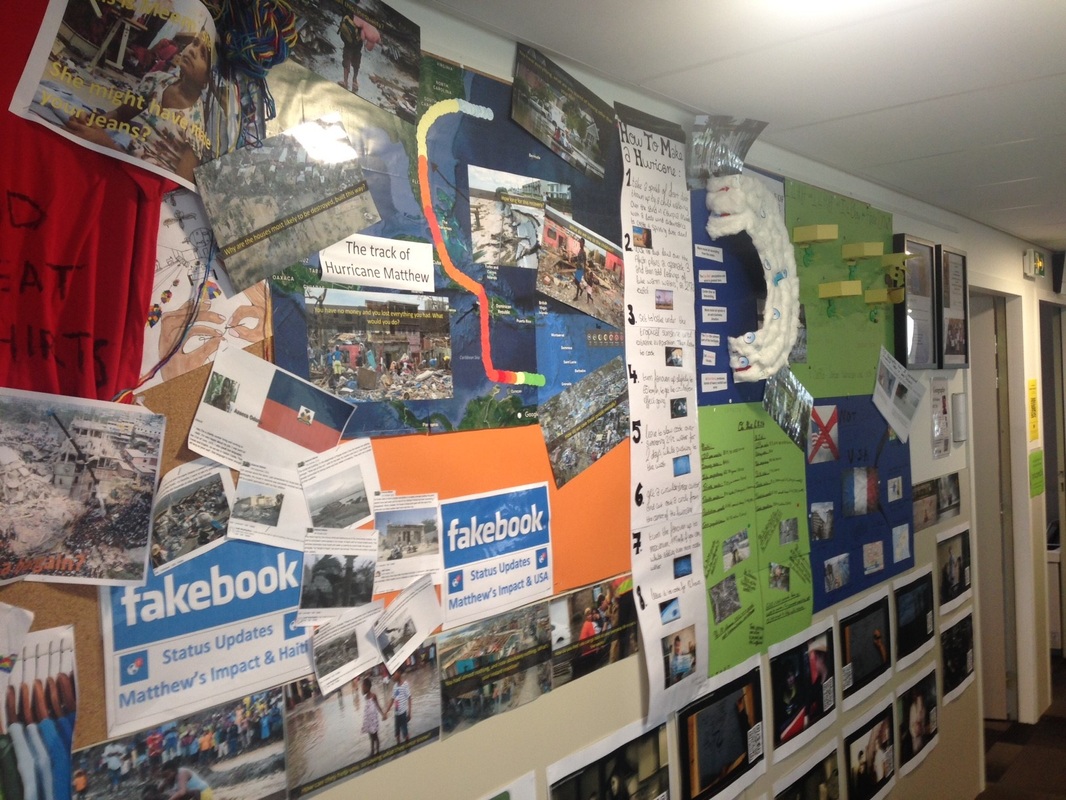 
I've tried out a new idea this week with my Year 9 students who are in the process of studying the Global Development unit of work. Instead of simply playing an old and pre-prepared development Snakes & Ladders game with them, I decided (about 5 minutes before the lesson) to let them design their own to showcase their own interpretations and experiences of global development. To put it into context, we have already studied a short unit deciding whether we should bin or teach the Brandt Line in 2016. This involved looking at key developmental data for a selection of countries to the north and south of this line and then making a reasoned judgement.
The conversation that followed initially led to the following rules. 1. The length of the snakes or ladders should be proportional to the impact that the factor has on development i.e. the longer the more detrimental/advantageous and the shorter the less the impact etc. 2. The 1-100 board works well in conjunction with the HDI league in that it is measured on a scale of 0-1. Countries can therefore be placed on the board in their current position or real world events assigned to countries (e.g. Syria was up to 0.63/64 on HDI in 2011 but has dropped back to 0.59 since the conflict started. On the board underneath, the Syrian civil war could be attributed to the snake on place 64 taking the county back to place 60 in 2013) 3. No current situation or country should be lower than square 35 on the board. This place represents the current position of Niger on 0.348. Similarly, no country should be placed higher than square 94 as this represents the current positioning of Norway. 4. Anything lower than 35 on the board could be a historical event, such as the Black Death, colonization, de-colonization, war, energy found. More than one group labelled the long ladder from square 28 as the industrial revolution in a named western country. The other option was to incorporate previous work on uncontacted tribes (link here) into this lower third of the board to show impacts of first contact etc. 5. Anything higher than Norway on the board has to be an imaginary future scenario. Knowing what we do about Norway and wealth generation, many groups used the snake in square 99 as oil supplies being depleted in the future and the country taking a step backwards in terms of HDI league placing. So, all in all, we had quite a varied game in scope as well as in geographical and historical accuracy. A mixture of real words events (snakes, ladders & flash cards) together will 2016 placings of example countries on the board linking to HDI ranking has given the students something to think about. All that is left is for both Year 9 classes to swap and have to play the game later this week. Anyone got a dice?
A short explanation from Hans Rosling about the reasons for the spread of Ebola in central Africa. Should be talked about extensively as part of all current IGCSE, IB & A level teaching of the subject.
|
AuthorAuthor of geographypods.com. Archives
May 2018
Categories
All
|

 RSS Feed
All content copyright geographypods unless otherwise stated.

|

|