
Land Use In Urban Areas
Objective: To find out how urban areas are structured in terms of land use and how this is changing in modern times.
Most cities, including your home town or city, have a land use pattern that stretches from the centre to the rural to urban fringe. We need to identify the patterns in our nearest large city - Toulouse.
Most cities, including your home town or city, have a land use pattern that stretches from the centre to the rural to urban fringe. We need to identify the patterns in our nearest large city - Toulouse.
|
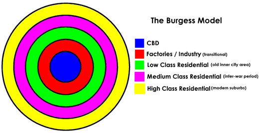
Task 1 - Watch the two videos to the right and fill in your worksheet about both the Burgess & Hoyt Model.
Task 2 - Study the embedded Google Map of Toulouse below.
Click on each of the five place markers and take a short tour, not forgetting to look up! Complete the worksheet below using the help sheet (also below) to be as detailed as possible in your analysis of our closest big city.
|
| ||||||
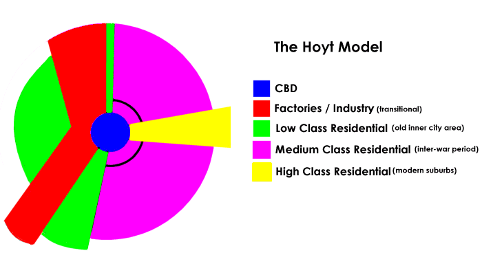
Diagrams reproduced from 'geography learn on the internet'
|
|
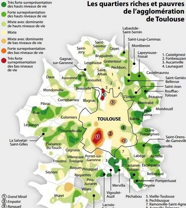
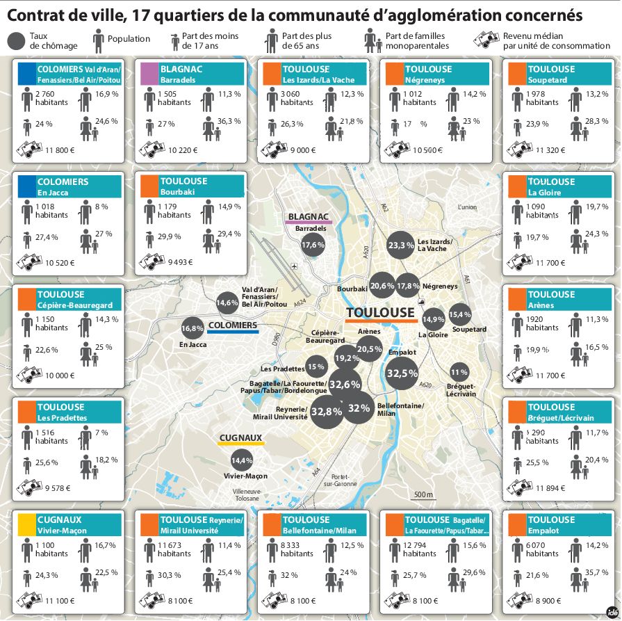
Inequality in Urban Areas - Toulouse
Task - Study the two images below. Complete a piece of analysis that identifies the pattern of wealth inequality in Toulouse. Use the data on the second image for instances of unemployment, family dynamics as well as average annual income €.
Haute Garonne - Data Here Gers - Date Here Pibrac (school) - Data Here
Additional information (in detail and in French) can be found here.
|
|
What Are The Different Types of Pollution?
|
Can you recognise different sorts of pollution that impact on people and places around the world? Use the worksheet above to try to identify at least four types of pollution.
Use the first 3.24 of video to the right to complete the note taking activity on the worksheet below. Remember, the word 'pollution' on its own doesn't mean anything. You must put a word (type) before it to give context. |
|
Problems of Urban Areas
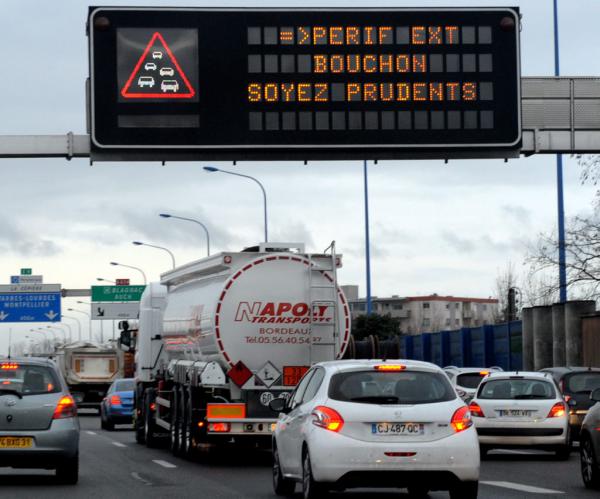
Case Study 1 - Toulouse & Congestion
Download the work booklet above.
Task 1 - Complete the first two activities on the first page of the work booklet.
Click here to be taken to a traffic map of the area around our school. On the 'Live Traffic' tab at the bottom of the screen, click the down arrow and select 'Typical Traffic'.
The busiest days in France are Tuesday's and Thursday's (the only days where everyone works!). Choose one of these days, and select 8am to see what the traffic situation is around the school. Check out what red, yellow and green mean.
Task 2 - Complete the two activities on page 2 of the work booklet.
Tackling Congestion in Toulouse
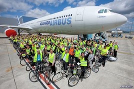
The Backgound - À Toulouse, le groupe Airbus emploie 23 000 salariés au sein de la division Airbus Commercial Aircraft et 5 000 salariés au niveau de la division Airbus Defence and Space. Au total, en comptabilisant les fournisseurs, les sous-traitants, les sociétés de service… ce sont 46 000 personnes qui se déplacent quotidiennement sur l’un des dix sites du géant de l’aéronautique et du spatial dans la métropole toulousaine.
|
Scheme 3 - New Line C Metro (Toulouse).
|
Scheme 4 - Téléo - Toulouse Cable Car Scheme
|
|
|
|
More information - Click here More information - Click here
Task 4 - Read over the information above and complete the table activity on page 3 of the work booklet also using the links and videos above.
How does this look in the examination?
Task 5 - Complete Question 9. This is a five mark question and so needs you to list and explain five different problems. Each one will take you two lines. It doesn't have to be about any particular place, just general information.
Task 6 - For a named urban settlement you have studied, state a problem faced by the people living there and describe what is being done to reduce that problem.
You will need to state the place 'Toulouse, France' and state the problem 'congestion' before describing the attempts which have been made to solve the problem .
You will need to describe three attempts.
Don't forget to PEEL:
Paper 1 - Congestion Question
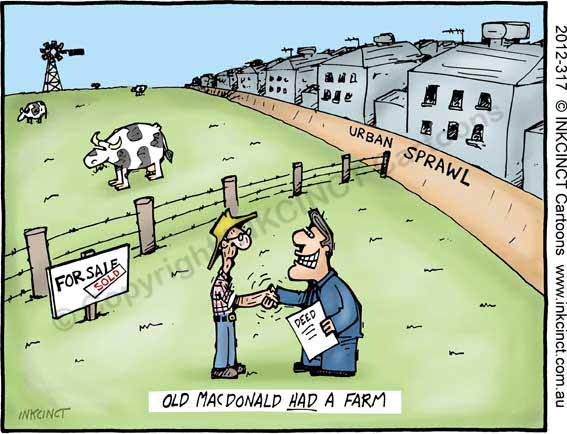
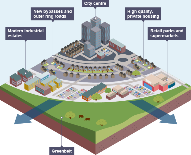
Urban Sprawl - What & How?
|
|
|
|
Defined as the spreading of urban developments (as houses and shopping centers) on undeveloped land near a city.
Task 1 - Complete the mind mapping exercise with you teacher using your local city as the example of Urban Sprawl. Task 2 - Use Google Streetview to explore an area around your city and how it has changed in recent years. See street-level imagery from the past. You can see old street-level imagery from the Street View's archives in the full version of Google Maps. For example, see how your neighborhood has changed over time.
You can also check out this before / after mapping site from IGN (France) to show you what our school area (and your home area) used to look like in the 1950's compared to today using a simple slide tool. |
Toulouse Urban Sprawl (around our school)
|
|
|
Task 3 - **IST Students** - Take a look at the two embedded Google Streetview tracks from 2008. They are taken in the immediate vicinity of our school. In both cases there is evidence that the surrounding area has developed and urbanised in the last 10 years.
Use the worksheet above to take a 'before and after' screen shot using both the 2008 and most recent Streetview imagery (see instructions above). Annotate on both the features of urban sprawl using information from the mind map in Task 1.
Use the worksheet above to take a 'before and after' screen shot using both the 2008 and most recent Streetview imagery (see instructions above). Annotate on both the features of urban sprawl using information from the mind map in Task 1.