
Settlement Characteristics
|
Objective: To be able to explain how physical factors (relief, soil, water supply) and other factors such as accessibility, agricultural land-use, influence the sites and patterns of settlements.
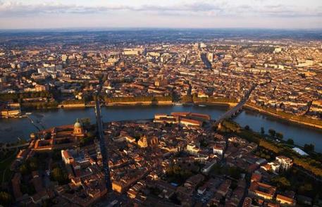
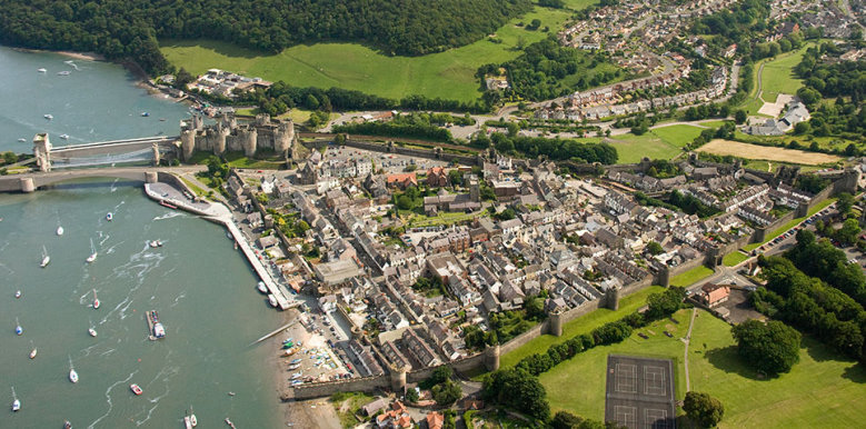
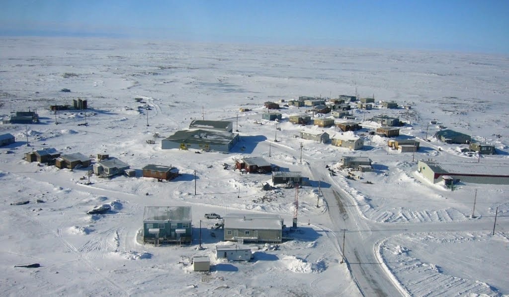
Settlement - A place where people live. A settlement can range from one isolated building to a capital city with over 20 million people like Mexico City. Starter: Watch the 10 of the world's most remote towns YouTube video to the right. Make a list of five things that prevent people from living in some places. Task 1 - Settlement sites - Click on the blue tab below to access your worksheet. Complete the activities set out before printing out for your folders. Task 2 - Settlements changing functions
Settlement function (what it does) may change over time. Using Google Street View for the settlements in task 1 (Conwy, Toulouse, Chesterfield Inlet & your home town), visit each place and look for evidence of the following ways that functions can change:
Annotate on any changes in function that you can see to your photos using a different colour. |
|
Settlement Patterns
|
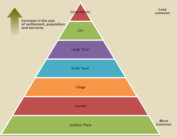
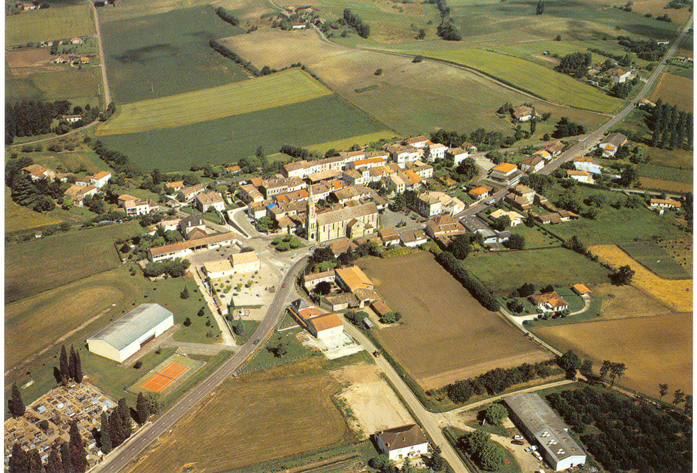
Settlements are places where people have settled down. Some settlements are really old (Toulouse) and some are quite new (Dubai). All settlements, including the place where you live can be categorised into a hierarchy (order of importance) like the one to the right.
Task 1 - Study the PowerPoint above right. Create your own worksheet that shows the hierarchy of settlements by matching up the relevant section of the hierarchy model with the correct picture, place, population number and description. **Click on each image to enlarge** Isolated Place - Just one dwelling surrounded by countryside. Hamlet - Perhaps a phone and a few houses. Village - Village shop, church, post office. Small Town - primary school, supermarket, library, bank, hotel Large Town - Shopping centre, secondary school, college, cinema, sports centre, City - Primark and other department stores, cathedral, university, football and rugby stadiums, airport. Conurbation - A city that has eaten up all the surrounding towns and cities and is now one big settlement under one name. 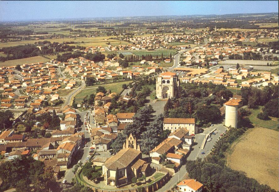
Pibrac Population 8000
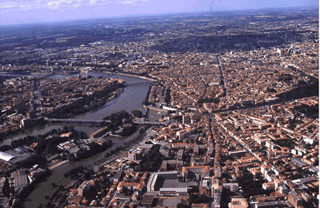
Grande Toulouse Population 1,200,000
|

Lombez Population 1800

Espaon Population 185
Levignac Population 2600
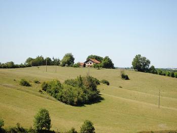
Laborde Fabien Population 4
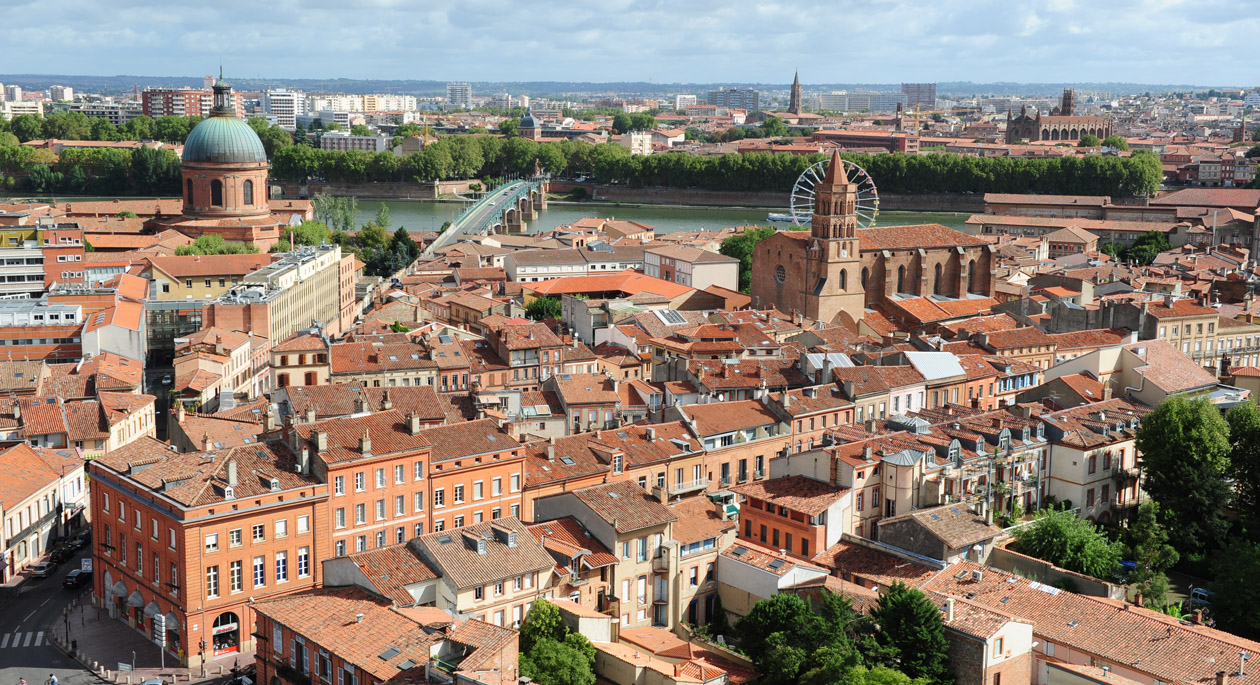
Old Toulouse Population 860,000
|
|
Task 2 - Click the blue tab to the right to be taken to a Google Earth tour of the seven settlements above.
i. Click on the 'Roads' and '3D Buildings' layers on the bottom right hand menu on Google Earth. ii. Look carefully at the communication routes through each type of settlement (roads, railways and metro (underground) stations. iii. Complete a piece of writing to complement your worksheet in task 1. You questions is: Can you find a link between the size of a settlement and the number of roads and railway, & metro stations? |

|
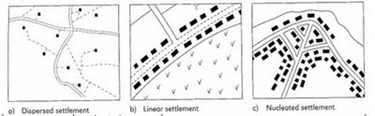
Rural Settlement Patterns
|
Objective: To be able to recognise the physical shape of settlements and to be able to explain why they look like that.
Task 1 - Study the PowerPoint to the right and practise your skills on the OS maps given out by your teacher. Task 2 - Click on the second blue tab to access the settlement patterns worksheet. Complete all tasks as set out. * - thanks to Caldew School Cumbria VLE for the PowerPoint ** - thanks to firefly.moorhouse.org.uk for the worksheet. |
|
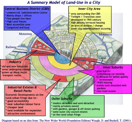
Changing pattern of
Objective: To find out how urban areas are structured in terms of land use and how this is changing in 2014.
Most cities, including your home town or city, have a land use pattern that stretches from the centre to the rural to urban fringe. We need to identify the patterns in our nearest large city - Toulouse. Task 1 - Study this presentation carefully. It contains comparative maps showing the growth of Toulouse over time. Then, complete this worksheet carefully using the presentation above as well as internet research. Task 2 - Use this worksheet and this BBC Geography revision site to identify different zones that exist within the city. Can you shade in and annotate zones from the Burgess or Hoyt model (or even both)? Task 3 - Study the two locations below carefully. One shows you a place in a Low Class Residential part of Toulouse and the other, the CBD. Use this Google Map to find four more Street View images that represent the zones that we have just identified on the map and record your information on the worksheet right. There is also a help sheet to the right to help you further. Need Help? Check out the sheet below.
|


| ||||
Congestion in Urban Areas
Now complete the two sample questions from the 2013 Paper 1 Examination below
Sustainable Greenwich
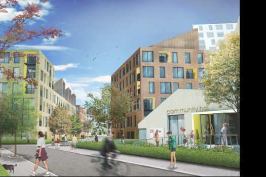
Objective: To find out how sustainable Greenwich Millennium Village is.
Task 1 - Study this presentation carefully and watch the news report embedded. Make a copy of the explanations of the different types of sustainability (SEE)
Task 2 - Using the map below, write a detailed location description, firstly of the location of London within the UK and secondly, the location of GMV within the conurbation of London.
Task 3 - Familiarise yourself with the project by visiting the official site here. Also, study this article from the BBC which gives readers the chance to comment on the development (bottom of the page) and this article that contains some of the drawbacks of the development.
Task 4 - Complete activities 1-7 on page 94-95 from the OCR B textbook. Use either the electronic copies on your laptop computers or the paper version. For activity 2, use this framework sheet.
Resources
Summary of the project
See below for two fact sheets created by students (thanks to http://rlp.romsey.hants.sch.uk and getrevising.co.uk)
|
|
|
|
|