0 Comments
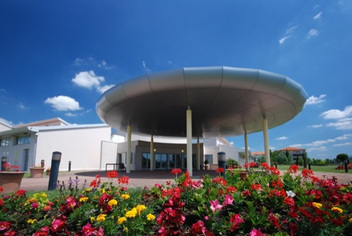 After a good, long summer break, school started for staff only this morning. For the first time in a long while, I haven't really been into to school over the holidays. A huge amount of building work and re-wiring in the classrooms meant that we weren't allowed and so today, my classroom looked a bit sorry for itself with the posters and displays peeling off the walls and tables and chairs strewn around. Unfortunately, due to the full schedule of training events today and tomorrow, I won't actually be able to do an awful lot before I welcome my new Year 7 form and their parents on Wednesday morning. I'll have to do a last minute spring clean after proceedings have finished tomorrow night and get things tidied up, learner profile posters (photos of geography students at work, in the field etc linked to IB learner profile) and a new information board for the new arrivals. Stepping back into the world of the form tutor ..... I have been out of the pastoral loop for three years now. Being the sole teacher of geography coupled with large classes at KS4 & 5 meant that I had to drop my original form class and free up registration & PHSCE periods for geography teaching instead. Of course, this meant an overall increase in workload but I am looking forward to getting back into the role with a new group of young students. It will be a stressful time for them, but they are generally off and running by the end of the first week back. Their biggest challenge will be getting to grips with their new laptop computers, working out network connections, Outlook email and the new Windows 8.1 system that we have just moved over to. Then there's the lockers, lost keys, spare keys, lost spare keys, caretaker with bolt cutters, lost network cables and all the other things that will crop up in the next couple of weeks too. I am lucky to only have 19 students in my form and so will aim to give them as much attention and support as I can to help them adapt to the world of secondary school. In terms of geography, I have been busy developing a couple of new areas on geographypods. I have been long overdue to complete the Otzi Ice Man SOW to compliment the work of Russel Tarr (my colleague down here) and the book written by Alan Parkinson (@GeoBlogs). We plan to launch Year 7 with a joint geo/history unit of work. I have blogged about this previously and we are hoping to add photos, video and share our experiences in our subject relevant twitterspheres. More about that next week..... I have also tried to introduce something new for Year 7 students (whilst we are waiting for them to complete the history part of the Ice Man mystery). The theme was inspired by Tony Cassidy, Alan Parkinson (not stalking him, I promise) and John Sayers at the GA conference in 2013. They ran a session called 'Poundshop Geography' in which one of the items was a washing line (information here). One of the suggestions was showing global interconnections (me, I think) where students connect themselves in an order based on a connection on both sides of them. I would like to do this with as few pointers as possible to get them thinking about everything from language, where they live, social media, clothing, computers, parents jobs etc etc. The outcome will be some sort of display that will hang from a washing line traversing my classroom. It is a bit of a jumble of ideas at the moment and I have tried to come up with a bit of a framework here on the geographypods site. This will change as I find out how the students cope with the task and won't be suitable for everybody in every school due to numbers, laminating etc etc. However, it does have the potential to grow into something good and with a bit of fine tuning, should be a really great way to launch the subject with the new Y7 students. It is something that could be revisited at the start of every year to see how those connections change and expand and would be a great geographical record of the careers of our geographers down here in Toulouse. More cross-curricular ...... Russ and I have also been gearing up for our Year 12 IB induction sessions. This involves the new IB students having two full days off timetable and using each of the six subject areas to discuss the the question Was World War 2 a time of progress and development? You can read more about the project here that is the brainchild of Russ and the resources for my contribution (focusing on Africa and decolonisation) can be found here. It always works really well and generates some excellent first attempt IB standard essays (and a bit of marking too to get me in the mood!) Other news ..... Last week, I was contacted by Larry Ferlazzo to write a piece on teaching creative geography for the USA publication 'Education Week'. The article, if accepted, should be published at some point this month and was the first that I have written for a USA based magazine. It was limited to a few hundred words and I would have liked to have written much more. I'll be interested to see how my U.S colleagues react to some of the activities in the article as they ranged from Everest role plays to Landscapes in a Box. Thanks for your feedback .... An lastly, I have received a lot of positive messages from users of geographypods recently from New Zealand, Australia, Switzerland and the USA. An increasing number of people use the website daily but as always with the internet, very few people ever leave any feedback (positive or negative), apart from the normal PayPal, hair loss and badly spelt swear words!. It is good to know that the content is sometimes useful and I hope that my playing around with the setup of the site, imagery and menu structure hasn't caused any issues in the last couple of weeks. Enjoy the first week back / last week of your holidays Matt
Other than that, I await to see if the department has achieved the SGQM from the GA and also to see if our application for Centre of Excellence has been accepted. It was a brilliant process to go through and deserves its own blog post, which I'll try to do when I get some time. One of my targets was to share my work more widely through blogging and by starting to write for the GA. I have a couple of ideas of interesting reflective pieces I would be able to write for the Teaching Geography GA publication but have never attempted this before so it will be a learning curve.
I have also committed to producing some Geography teaching resources for the GapMinder team in Sweden. They have provided me with a series of as yet unpublished Hans Rosling videos and asked me to write some resources to go with them. I love the GapMinder site and our kids are really enthused by it too. I was very honoured to get a tweet from Hans Rosling (which has been the Tweet of the Week on the geographypods.com frontpage for the last 12 weeks!!) as he had seen the work on the World Cup in Brazil and given it his seal of approval! There will also be some fairly significant changes to geographypods in the coming year as I look to expand the number and variety of topics that are covered and tighten up on some of the content in IB & IGCSE. My aim is to incorporate more worksheets into the site that can be easily downloaded and edited to suit both my students and others who use the resources. I will also be changing some of the case studies to more up to date events and trying to get GapMinder into the site as much as possible. I just wish the data visualisations could be embedded into the site but there are no plans to allow this to happen as yet. The Year 8 Brazil World Cup resource will eventually morph into the 2016 Rio Olympics page. It will be massively interesting to see what other changes and modifications are made to the infrastructure of the city and if and how the existing facilities will be altered to host the games. Of course the social and economic impact will again be the focus in the lead up to the Games and I hope to produce something of similar quality that can be used to improve the understanding of the relationship between sport and development. The resources on Brazil were viewed over 30,000 times on geographypods and I didn't get any complaints. Hopefully, that means they were good and colleagues enjoyed the activities within. IB results were released and I was generally pleased by what my students attained. Another year where we managed to get at least one Level 7 and as a result, everyone got to their first choice university or college. IGCSE results have just been released today too. I must say I was dreading these as a) it was the first run through and b) I had a class of 40 students and so it was a bit stretched to say the least! Initial analysis is that the results don't seem to be concerning. The very low ability students have suffered from the sheer amount of content and revision necessary and having no tiered entry (like our previous OCR B qualification). We have a pleasing number of A results and a smattering of A* too. However, we are someway short of the number of A* results attained in history and so another focus will be looking into how I can do more to transform some of those A's into A*'s. I have started a discussion on the IGCSE grades over at the support Ning that I created - http://igcsegeography.ning.com/ That's all for now. Hungry child calls. Just spent five hours trying to get my thoughts down and activities prepared to use with the recent Hans Rosling BBC2 documentary. It is very much something that I have been interested in for a long while and can't help but feel that we are being prescribed case studies, situations and data that really doesn't represent our world in 2013. There were some really positive things highlighted in the programme but some major issues too that weren't covered such as future oil use and energy sources linked to massive increases in future car use in those economies who are fast catching up.
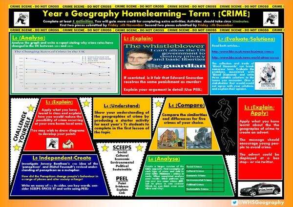
I really loved the approach to the graphics and the good old fashioned ladder to illustrate the perspective that we have of other places based on the information that we are fed. I do think that textbooks in Geography should take some responsibility for this and in their clamour to become exam board approved (they too should not be exonerated with their constant MEDC LEDC comparison LEDC's should learn how to do it better, be sustainable etc etc) they use old and out of date data, maps and charts that are far from a true reflection on those countries now. It worries me that they will be doing the same for the new curriculum and qualifications too. The stuff that Hans Rosling talked about will make me go back though geographypods and question, update and delete resources that are now proved to be out of date or just plain misleading. IB gives us greater scope to do exactly as Hans Rosling said - question data and focus on good news and positive developments. The iGCSE also does the same and does not have the same focus on MEDC v LEDC but thinking back to OCR B and AQA A that I previously taught, this really was the core of the course and something that I felt very uncomfortable with. Let's hope that people from the exam boards were watching and that the RGS & GA also noted it down. Moreover there is now an army of Geography teachers (judging by the excitement on Twitter last Thursday) who are going to be able to update their resources and change the way that population & development is taught. The start of a new chapter I hope. Anyway, enough ranting and better start doing........ Work is here: http://www.geographypods.com/dont-panic---the-truth-about-population.html Night Really like the way that this homework project has been set. This is just a record for me to come back to and try to develop down here in Toulouse at some point. Thanks to @WHSGeography for posting
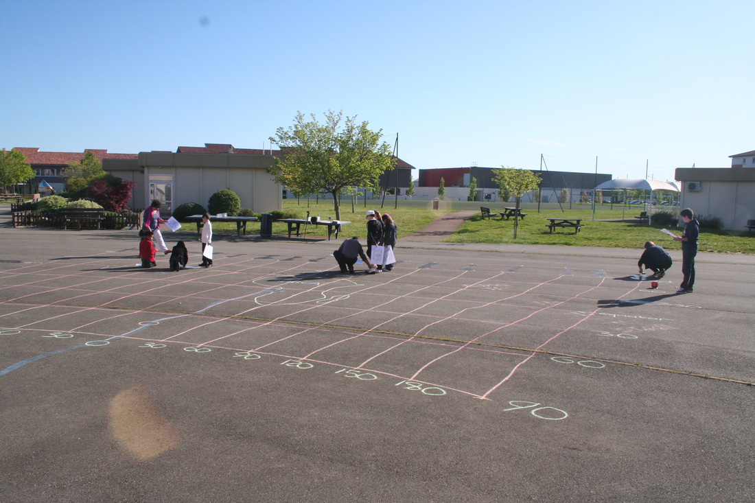
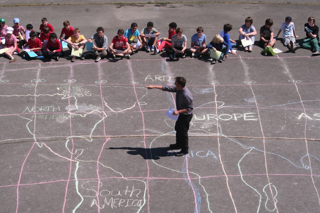
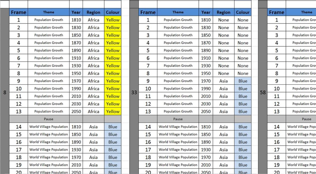
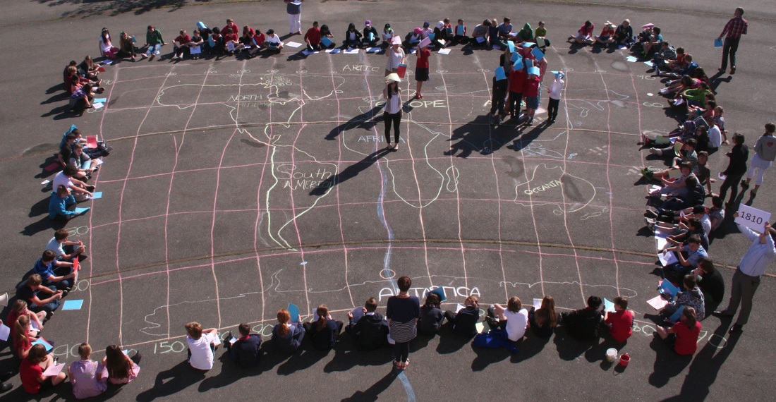
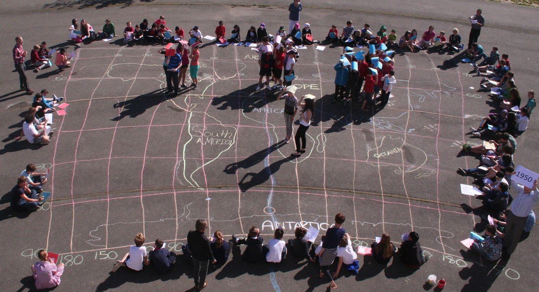
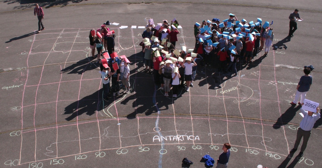
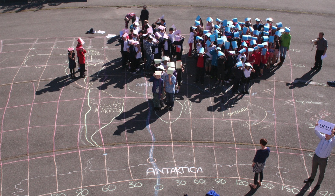
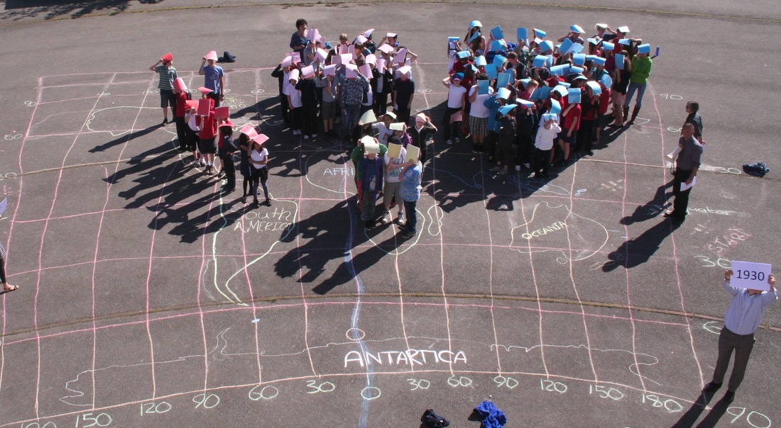
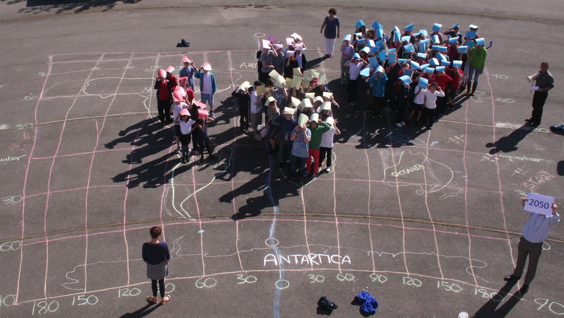
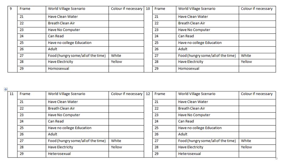
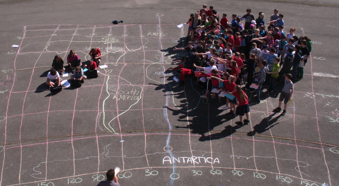
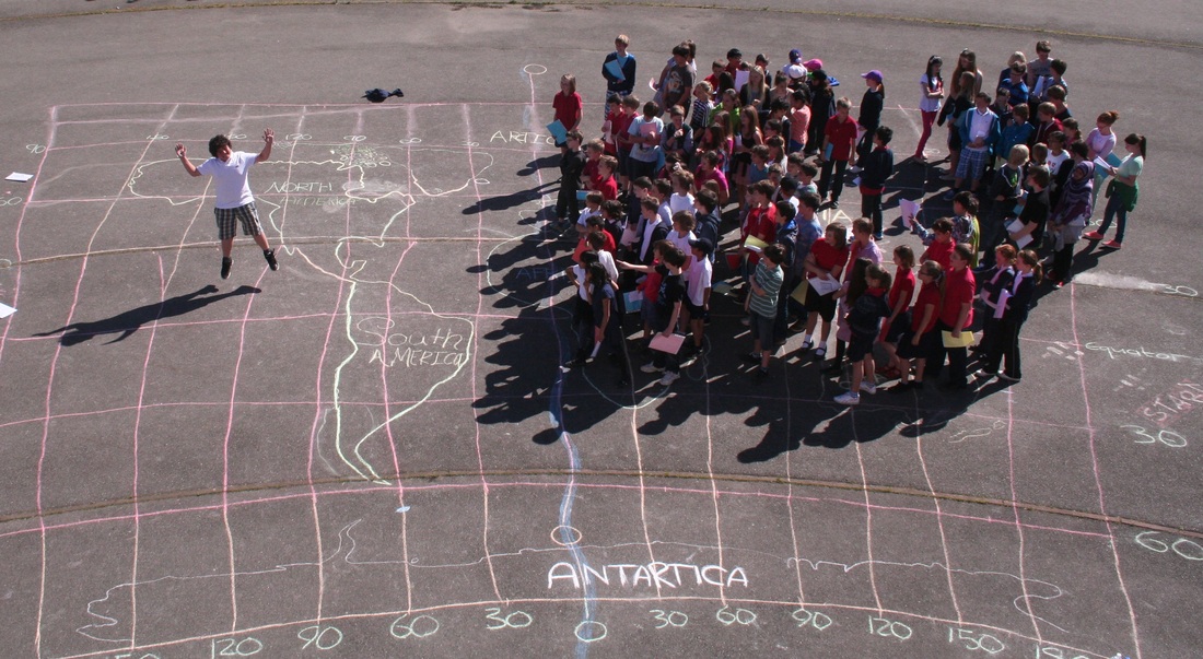
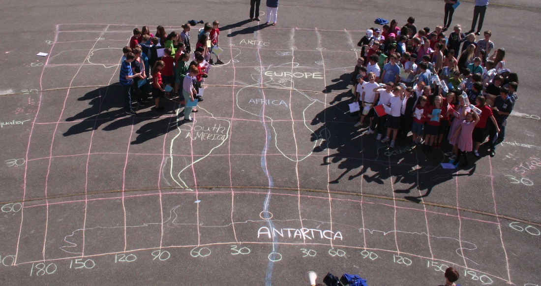
I have been working with Jim Noble, the Head of Maths at IST, and preparing for the forthcoming visit of GapMinder to the school next week. They would like to come in to school and see how we currently use their site and resources in Maths & Geography lessons. Both Jim and I have ideas on how we would like GapMinder to develop resources or allow the editing of resources for a school. We thought we might do something a bit out of the ordinary with the students in preparation for the visit and produce something very visual that could be used in conjunction with the Gapminder site next Monday during their visit. We decided to get together 100 students from Year 5, 6 (crossover), 7 & 8 and provide them with easy to read scenarios that would tell them where they needed to be placed on a world map and a colour that they would need to hold above their heads. Each student was given a plastic wallet with 5 different coloured pieces of paper and two sets of instruction cards. This was a huge amount of work and all credit to Jim for persevering with the creation of the cards on Excel during his Easter holidays. This morning we had to draw a decent(ish) map on the school yard with the help of some Year 5 & 6 students and their teachers, Simon Gregg & Isobel Patrick. The activity had been planned by Jim in three stages. Stage 1 - Population Growth from 1810 to 2050 (projected) in 20 year intervals As I stated above, Jim had the unenviable task of going back through all the raw data, extracting information, setting up an Excel spreadsheet and creating, cutting and sorting 100 individual cards that for the 20 stages. Each card told any particular student where they were to stand and what colour they should hold up above their head. Above is a screen shot of a couple of the cards so you can see how it worked. Jim then positioned himself on the roof of the school (after lengthy 'elf and safety' discussions) to take photos and videos of the scenario as they unfolded whilst the students were directed into position by fellow colleagues Ollie Bowles, Amanda Vaile me and a megaphone by simply shouting the number out. This was done and photographed 13 times for stage 1 and I have included three examples beneath from the Population Growth Rate Sequence Stage 2 - World Village Population Numbers from 1810 to 2050 to show recent advances in population growth in Asia and Africa. Students had this information on the cards above and so simply calling the numbers out ensured that the students moved to the correct continent at the correct time. We are going to put together a time lapse video of this event to make the movements and changes more pronounced. Stage 3 - World Village Disparities. I had the more straightforward task (still took 3 hours) of creating this set of cards that showed the global disparities using the information contained here on Pinterest. Again, there were 100 cards for each student showing a stage number and colour card. There were also a separate set of instructions for the students of what they should do when they were in position. We have now got our time lapse video set up and I'll post it here when it is sorted and edited. We are going to hand these images over to the students now to use in conjunction with PhotoShop and GapMinder and see what we come up with in the lead up to the Gapminder visit next Monday. This time will give students the time to reflect on what they have been part of as due to time constraints, we couldn't explain scenarios as and when they were underway. They did pick up on the computer and college education disparity quite quickly though!! Was great to attend the 200 heads is better than one event at the recent #gaconf13 in Derby. Just posting this here for the time being so that I can get my head around it in the Easter break (yeah, we don't break up until the 19th April). Was great to meet John, Tony and Alan and was one of the best sessions that I attended. More thoughts later. 2 hundred heads from GeoBlogs ... and before all the First Contact work, Y9 have been very busy working on their Niagara Falls sustainable tourism piece of work. This has replaced the Niagara Falls tourism brochure which I think had run its course. They did a really good job of this and the displays in the room have attracted some positive comments from other students. Here are a few examples. I have been using my Y9 students as guinea pigs to test out a new variation to the ecosystems unit of work. I have included some work on First Contact and after some research, the students were tasked with painting a scene (using Amazonian style art) or writing a letter to explain how their lives were about to change. These are some of the results: I have been experimenting today with a new tool produced by @russeltarr and I really like the potential of this one. Just had a quick play to test its embedding potential in geographypods and all seems to work well. Really easy to use, takes no time to put together and I hope to use further in my teaching. Here is a hastily put together brainbox for the Y9 assessment on Palm Oil. More later. Matt |
AuthorAuthor of geographypods.com. Archives
May 2018
Categories
All
|


 RSS Feed

