
How have geomorphic processes altered the coastline in Sitges &
how have people tried to manage these processes?
how have people tried to manage these processes?
Deadline: 4 July 2024
The documents underneath are vital to your fieldwork study. You already have a paper copy of the Fieldwork Booklet, but you will need to save a copy onto your computer and download the other documents underneath.
|
|
Chapter 3 - Data Presentation
(graphs, photos, charts)
You are going to need to present your data to enable you to effectively answer both of your research questions.
Although you are going to complete some of these graphs and charts separately, they are going to be embedded as part of Chapter 4 so that you have your presentation and interpretation all together.
First part of RQ - How have geomorphic processes altered the coastline in Sitges?
For this question you will need the following:
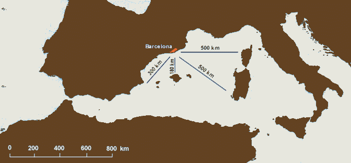
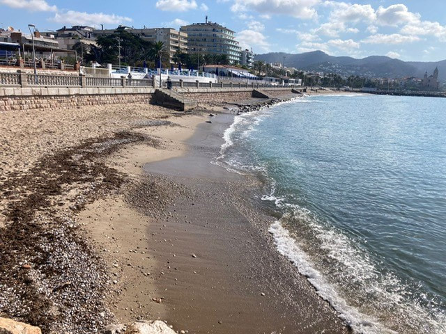
1. A geology map of Sitges. This shows that there are bands of both hard rock and soft rock around Sitges. A good idea here is to use this map and add some photos around the edges to show the features that can be found e.g. beaches and sea walls where there is soft rock (sands and gravels) and the hard rock (limestone) headland etc and unprotected beach.
2. Your field sketch of the hard rock features beyond the nightclub. A neat annotated and coloured in copy is fine.
3. The erosion and wave attack information sheet on page 10 of this document.
It should be noted that for the 2023 results for longshore drift match with the second highest frequency of wave attack from the south west.
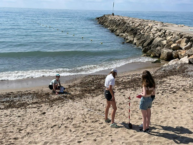
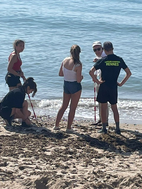
4. Beach width and longshore drift data to show that erosion is happening and that LSD is also occurring*.
Beach width - Beach profile on graph paper
LSD - located bar chart using the data and mounted on an A3 satellite view of Sitges. It should look like this when completed.
**For higher level analysis, you might want to see how the situation has evolved since 2015. Here is the data that the class collected 7 years ago. Have erosion levels increased since then?
Second part of RQ - ...... how successfully have people tried to manage these processes?
For this question you will need to present:
5. Annotated photos of the rock islets, sea wall and stone groynes.
6 . Bi Polar Analysis of the three defences that you analysed in Sitges (sea wall, groynes & rock islets).
You will need this Microsoft Excel template to plot the results as a bar chart.
7. An annotated satellite map to show why the more complicated sea defences have been used on beach 6, 7 & 8.
Check this house for sale advert out from September 2022. Here is the actual location of that house. Turn around to face the sea. What do you see?
Although you are going to complete some of these graphs and charts separately, they are going to be embedded as part of Chapter 4 so that you have your presentation and interpretation all together.
First part of RQ - How have geomorphic processes altered the coastline in Sitges?
For this question you will need the following:
1. A geology map of Sitges. This shows that there are bands of both hard rock and soft rock around Sitges. A good idea here is to use this map and add some photos around the edges to show the features that can be found e.g. beaches and sea walls where there is soft rock (sands and gravels) and the hard rock (limestone) headland etc and unprotected beach.
2. Your field sketch of the hard rock features beyond the nightclub. A neat annotated and coloured in copy is fine.
3. The erosion and wave attack information sheet on page 10 of this document.
It should be noted that for the 2023 results for longshore drift match with the second highest frequency of wave attack from the south west.
4. Beach width and longshore drift data to show that erosion is happening and that LSD is also occurring*.
Beach width - Beach profile on graph paper
LSD - located bar chart using the data and mounted on an A3 satellite view of Sitges. It should look like this when completed.
**For higher level analysis, you might want to see how the situation has evolved since 2015. Here is the data that the class collected 7 years ago. Have erosion levels increased since then?
Second part of RQ - ...... how successfully have people tried to manage these processes?
For this question you will need to present:
5. Annotated photos of the rock islets, sea wall and stone groynes.
6 . Bi Polar Analysis of the three defences that you analysed in Sitges (sea wall, groynes & rock islets).
You will need this Microsoft Excel template to plot the results as a bar chart.
7. An annotated satellite map to show why the more complicated sea defences have been used on beach 6, 7 & 8.
Check this house for sale advert out from September 2022. Here is the actual location of that house. Turn around to face the sea. What do you see?
Checklist before final hand in
- Contents Page
- All pages numbered
- All photos, graphs, charts etc numbered in order e.g. fig 1, fig 2 etc
- Header of your name & Candidate Number
- Footer of International School of Toulouse FR042
- Front Cover with the following:
How do geomorphic processes affect the coast in Sitges, Spain?
Your Full Name
International School of Toulouse
FR042
An Image
Paper 3 - Coursework
iGCSE Geography 0460
Word Count (should be no more than 2000).