
Introducing Settlement Patterns
|
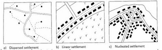
Objective: To be able to recognise the physical shape of settlements and to be able to explain why they look like that.
Task 1 - Study the PowerPoint to the right and practise your skills on the OS maps given out by your teacher. Task 2 - Click on the second tab to access the settlement patterns worksheet. Complete all tasks as set out. * - thanks to Caldew School Cumbria VLE for the PowerPoint ** - thanks to firefly.moorhouse.org.uk for inspiring the worksheet. |
|
Factors influencing the sites, growth and
functions of settlements
|
Objective: To be able to explain how physical factors (relief, soil, water supply) and other factors such as accessibility, agricultural land-use, influence the sites and patterns of settlements.
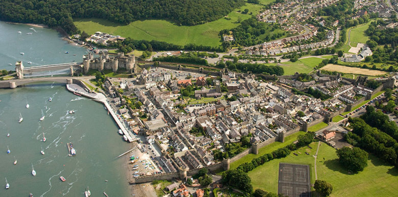
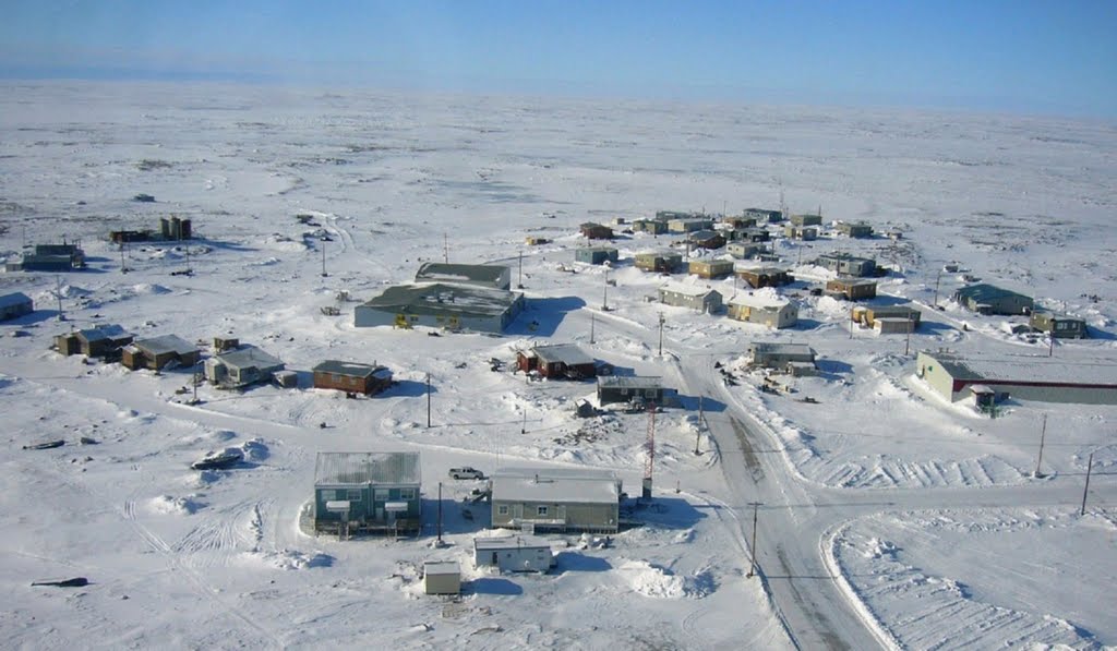
Settlement - A place where people live. A settlement can range from one isolated building to a capital city with over 20 million people like Mexico City. Settlement Site - The site of a settlement is the land upon which it was built. There is a range of human and physical factors that determine the site of a settlement. Settlement Situation - The situation of a settlement is its location in relation to surrounding human and physical features. We usually describe the situation when we are telling someone where a settlement is. Starter: Watch the Human Planet BBC video to the right. This shows people living in areas that are right on the limit of what we can survive. What factors stop people from living in certain places? Task 1 - Settlement site & situation - Click on the tab below to access your worksheet. Complete the activities set out before printing out for your folders. Task 2 - Settlement Situations & Changing Functions Settlement function (what it does) may change over time. Using Google Street View for the settlements in task 1 (Conwy, Toulouse, Chesterfield Inlet & your home town), visit each place and look for evidence of the following ways that functions can change:
Annotate on any changes in function that you can see to your photos using a different colour. |
|
Settlement Hierarchy & Service Hierarchy
Source of diagram: http://fsherrenpgcesettlement.blogspot.fr/2013/08/the-characteristics-of-rural-settlements.html
Task 1 - Make a copy of the two diagrams above using the worksheet on the blue tab above. Then read, copy and highlight the text beneath.
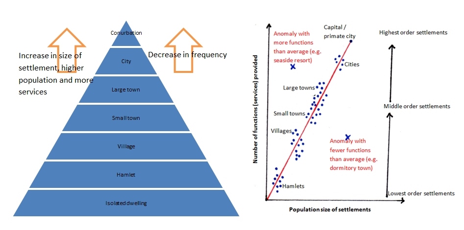
As you move up the hierarchy, the size of the settlement and the distance between similar sized settlements increases. As you can see from the diagram below, there are more cities than conurbations, more towns than cities and more villages than towns.
The number of services that a settlement provides increases with settlement size.
Small settlements will only provide low-order services such as a post offices, doctors and newsagents. Large towns, cities and conurbations will provide low and high-order services such as leisure centres, chain stores and hospitals.
Larger settlements and conurbations have a much larger sphere of influence than smaller ones. This means they attract people from a wider area because of the facilities they offer. Cities such as Paris have a global sphere of influence, whereas a small hamlet or village may only have a sphere of influence of a couple of kilometers.
Services such as department stores selling high order goods have a higher threshold than those selling low order goods such as newsagents. This means they need a higher number of people to support them and make them profitable, therefore they will only be found in larger settlements. It also means that there are fewer big department stores than small newsagents.
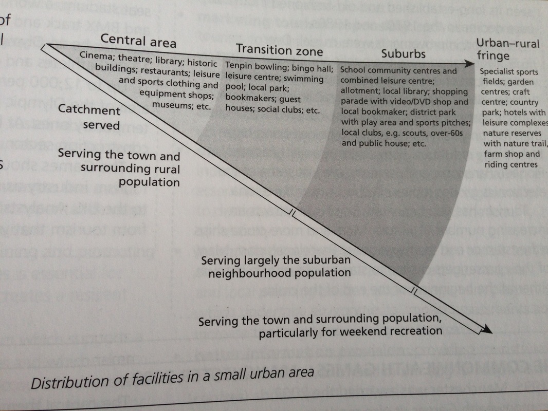
hierarchy of leisure services in an urban area - click to enlarge
|
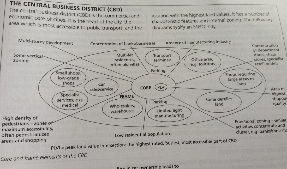
Hierarchy of service provision within the CBD - click to enlarge
|
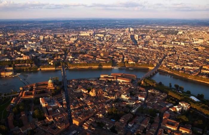
Settlement & Service Provision in Toulouse
|
Task 2 - Use the second side of the worksheet from Task 1.
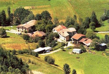
Complete the activities on the sheet by using the resources below. Settlement Definitions. Isolated Place - Just one dwelling surrounded by countryside. Hamlet - Perhaps a phone and a few houses. Village - Village shop, church, post office. Small Town - primary school, supermarket, library, bank, hotel Large Town - Shopping centre, secondary school, college, cinema, sports centre, City - Primark and other department stores, cathedral, university, football and rugby stadiums, airport. Conurbation - A city that has expanded into the surrounding towns (urban sprawl) and is now one big settlement under one name. 
Pibrac Population 8000

Grande Toulouse Population 1,200,000
Task 3 - Click on the blue tab above to access the Google Map and study the location of each of the settlements above.
i. Look carefully at the communication routes through each type of settlement (roads, railways and metro (underground) stations. ii. Complete a piece of writing to complement your worksheet in task 2. Your questions is: Can you find a link between the size of a settlement and: ** the number of roads and railways and other forms of transportation. ** the shape of the land (relief) ** proximity of other settlements. |
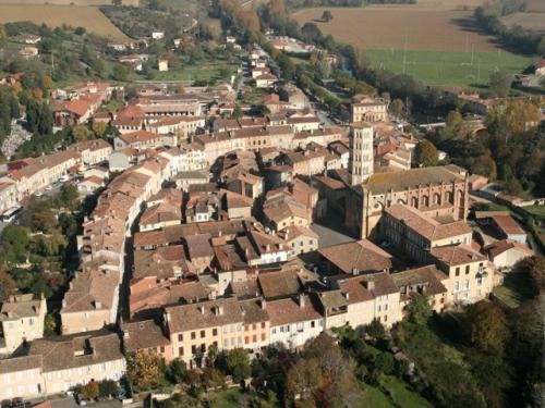
Lombez Population 1800
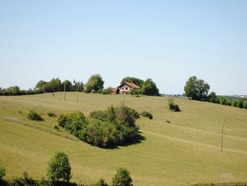
Espaon Population 185
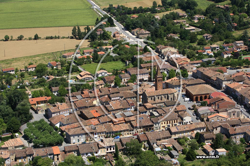
Levignac Population 2600
Laborde Fabien Population 4
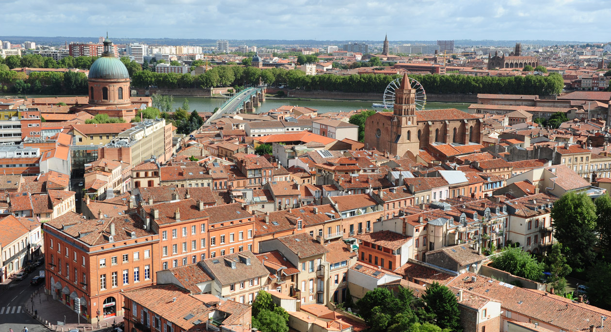
Old Toulouse Population 860,000
|
In Summary - Toulouse - Colomiers - Pibrac
To complete this task, please click on the tab below to access the worksheet.