Dynamic Earth - Plate Tectonics
|
|
|
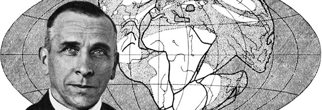
Objective: To discover how our planet it structured and how tectonic plates move and their resultant features. You will be completing the work booklet to the right (grey tab). Each of the tasks corresponds with a task below. Task 1 - It is a good skill to be able to complete sketch maps in IGCSE Geography.
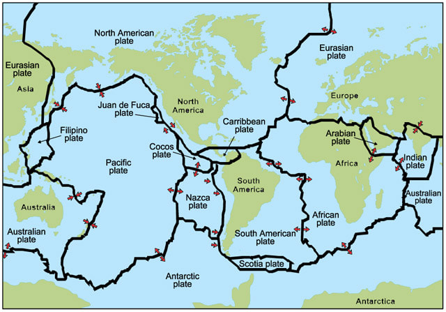
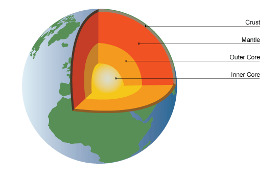
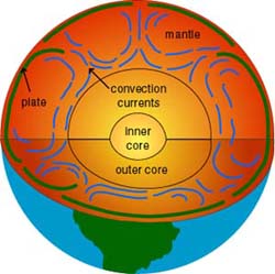
Click here to play a game! To make your life a little more difficult, you are going to plot the information above but onto a blank Pacific Centred map of the world. Task 2 - Label each of the plates and add the direction arrows and identify and label 'The Pacific Ring of Fire'. Task 3 - There are two types of 'earth's crust': i. Oceanic Crust ii. Continental Crust Using this link, explain the main differences between them both. On the Move - Continental Drift Task 4 - Watch the video to the right hand side and then have a play with this fantastic tool. Stop the video when you recognise any landmass e.g. North America. What period was that? Task 5 - Take a screenshot of now and 100 million years from now on the YouTube video. Annotate the major differences between now and in the future. Try to find at least five differences. How has the location of your home country changed? Why do we move? Task 6 - Study the cross section diagram to the right that shows a new feature - convection currents. Watch the quick video below too for extra explanation. Take a copy of the cross section to the right and then sort out the 8 statements below into the correct order underneath. Don't forget to add a title to your work. This process is known as 'convection currents' The rising and falling magma creates circular currents with the mantle The less dense magma then starts to rise towards the crust The cooling magma becomes denser and begins to sink As the magma warms it expands and becomes less dense. It is these currents that create friction with the crust above and causes it to move. Magma (semi-molten rock) near the outer core is heated. As the magma nears the crust it begins to cool. |
|
Plate Tectonics & Volcanoes
Objective: To link volcanic activity to plate boundary locations and to find out why some volcanoes are more violent than others.
|
Task 1 - Watch the first 15 minutes of the YouTube video (Montserrat, Etna & Smoke Rings). This is a video featuring John Seach, a very famous vulcanologist. Here is his website (Volcano Live). Have a look at some of the videos he has taken - amazing!
Task 2 - Internet Based - Find the locations of the following volcanoes: a. Mount St Helens b. Cotopaxi c. Mont Pelée d. Eyjafjallajokull e. Mount Vesuvius f. Krakatoa g. Mount Pinatubo h. Unzen i. Mount Etna j. Nevado del Ruiz Plot and annotate the locations of these volcanoes onto the worksheet above. |
|
Task 3 - Now using the second video above, complete a diagram with accompanying notes on how destructive plate boundaries can result in the formation of volcanoes. You might want to use this basic diagram to help you, but you will need to add annotations.
Plate Tectonics & Earthquakes
|
Objective: To understand where in the world earthquakes occur and the type of boundary that causes them.
Starter: Spend 5 minutes watching the National Geographic video to the right. Task 1 - Where do powerful earthquakes happen? Click here to access the Wikipedia information on earthquakes and in particular the most powerful quakes of all time. Plot the top 10 earthquake (by magnitude) locations onto the same A3 sheet that you plotted the volcanoes on (from last lesson). Use a suitable symbol to show earthquakes. Task 2 - Finding out more about the causes of earthquakes Please complete all tasks set out on the worksheet below. **You will need your A3 sheet from last lesson too** For the final spider diagram task, use the last video to the right to make a note of the key factors impacting the severity of an earthquake event. |
|